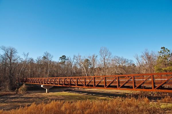
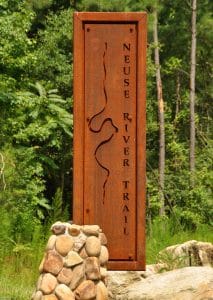
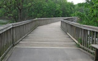
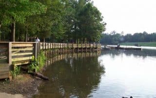
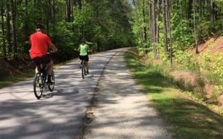
The Neuse River Trail is a 33-mile (53 km) paved greenway running along the banks of the Neuse River from Falls Lake Dam in the north to the town of Clayton in the south. It offers scenic views of the Neuse River, winding boardwalk areas through wetlands, historical sights, interpretive signs, and agricultural fields. The trail has several river crossing spots with a great view of the wetland beneath it. The closest pass to central Raleigh is about 9 miles east in Anderson Point Park. An interesting note: this is the longest paved trail between northern Virginia and western Georgia.
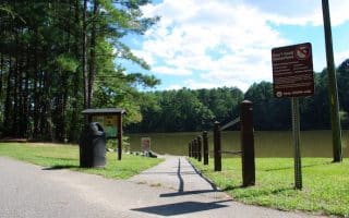
A good access point is at ~mile 19 on the Neuse River trail, where it intersects with the Walnut Creek Trail, near the I-40/I-440 interchange, with a parking lot at Poole Rd.
The best bet for runners is to pick your spot. Like many other trails in the area, this one is gently rolling. It’s very well signed.
The Neuse River Trail is a 33-mile (53 km) paved greenway running along the banks of the Neuse River from Falls Lake Dam in the north to the town of Clayton in the south. It offers scenic views of the Neuse River, winding boardwalk areas through wetlands, historical sights, interpretive signs, and agricultural fields. The trail has several river crossing spots with a great view of the wetland beneath it. The closest pass to central Raleigh is about 9 miles east in Anderson Point Park. An interesting note: this is the longest paved trail between northern Virginia and western Georgia.
A good access point is at ~mile 19 on the Neuse River trail, where it intersects with the Walnut Creek Trail, near the I-40/I-440 interchange, with a parking lot at Poole Rd.
The best bet for runners is to pick your spot. Like many other trails in the area, this one is gently rolling. It’s very well signed.
Scroll Down For Route Maps
Essentials
Up to 33 miles, so pick any distance!
Gently rolling
Any point. Closest to Raleigh is near Anderson Point, at Poole Rd. parking lot (see map)
Car needed to access trail. Poole Rd. parking lot is closest access point to Raleigh
Design your own route in downtown Raleigh, incorporating the streets around the stately Capitol, some of the pleasant streets heading toward NC State, the Rocky Branch Trail, Pullen Park, and the NC State Campus itself.
Large park between Raleigh and Durham, with 20+ miles of trails. The 13 miles of 'bridle path' trails offer gentler, shaded running. Also some great trail running opportunities. Two separate entrances, leading to different trails.
Pleasant, paved 2-mile trail around Lake Shelley, located 7 miles north of downtown. Water views a good part of the way. For a longer run, there are additional trails at the north and south ends of the lake.
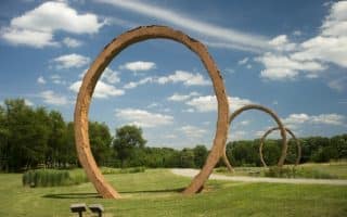
An art run! A 1 mile loop trail passes by several outdoor pieces and sculptures. Then, connect to the 4-5 miles other trails in the area. A good opportunity for something different.
Pleasant lake 5 miles west of Raleigh, with running trails around its perimeter. Paved 3.5 mile loop, or 5.4 mile loop incorporating 1.9 miles of unpaved trails to make a 'figure eight'. Good shade options.
Pretty park 10 miles west of Cary with 4.2 miles of trails, a lake, amphitheater, rope course, and athletic fields. We've mapped a 2-mile route around Bond Lake and a 2-mile loop of interior trails.
The 160-Acre Apex Community Park is a pleasant spot for a 2-3 mile run in the Cary area, 20 minutes west of Raleigh. The highlight is the 2-mile paved trail around the lake, part along the water, and part in the woods.
There are 18 miles of paved, dedicated jogging trails in the center of Research Triangle Park, near The Frontier and RTP Headquarters. Many loop options available, and a good map. Fairly shaded.
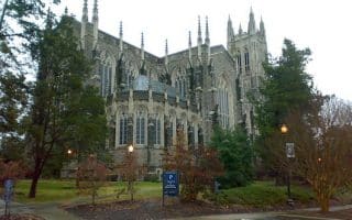
One of the prettiest campuses in the USA and wonderful for running. Enjoy the Georgian-style east campus or the Gothic west campus. Run up to the Duke Chapel, do the 3.7 mile Al Buehler Trail loop trail, and don't miss Sarah Duke Gardens in spring!
A 5k Parkrun in Southern Boundaries Park, which is 4 miles south of Durham. The course is all off road. It's a mostly flat two loop lollipop course on the Third Fork Creek Trail.
One can stitch together a really nice run in Chapel Hill, incorporating the festive downtown, the pretty UNC Chapel Hill Campus, and the Battle Branch and Bolin Creek Trails, which together are 3 miles one-way.
22+ mile rails-to-trails path that starts in downtown Durham and heads south. The first 14 miles are paved. A fairly flat, easy to follow run. Good option in the Durham/Duke/Chatham area.
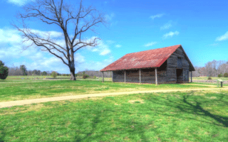
3 miles of lovely paved trails in this Wake Forest park. Meadows, stone walls, pecan groves, and restored farm buildings. A lovely mix of open and shaded, with excellent signage and interpretive information.
Two lovely parks in the Holly Springs area, linked by an off-road connector trail. A loop around Bass Lake is ~2 miles, and the paved trails around Womble Park are ~ 1 mile. Full route of both parks is ~5.5 miles.
Share your feedback on this route and see that of other Great Runs users. Click on the image icon to upload a photo. And please let us know if there are notes or changes we should incorporate!
Subscribe
0 Comments
Oldest
Newest
Inline Feedbacks
View all comments
Essentials
Up to 33 miles, so pick any distance!
Gently rolling
Any point. Closest to Raleigh is near Anderson Point, at Poole Rd. parking lot (see map)
Car needed to access trail. Poole Rd. parking lot is closest access point to Raleigh
 The Neuse River Trail is a 33-mile (53 km) paved greenway running along the banks of the Neuse River from Falls Lake Dam in the north to the town of Clayton in the south. It offers scenic views of the Neuse River, winding boardwalk areas through wetlands, historical sights, interpretive signs, and agricultural fields. The trail has several river crossing spots with a great view of the wetland beneath it. The closest pass to central Raleigh is about 9 miles east in Anderson Point Park. An interesting note: this is the longest paved trail between northern Virginia and western Georgia.


Review or Comment on This Route/Share a Photo!
Share your feedback on this route and see that of other Great Runs users. Click on the image icon to upload a photo. And please let us know if there are notes or changes we should incorporate!