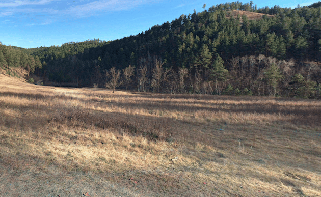
The Storm Mountain trail network is located about 15 miles southwest of Rapid City. It is mostly comprised of single-track, with some challenging climbs. The main trail, an 11.5 mile loop, is beloved by mountain bikers and hikers, but those new to trail running might find it a bit on the technical side. There are also some shorter options in the 3-6 mile range for those who prefer to explore a less-intense trip through this pine forest. The 2 mile (one way) Forest Road is a perfect double track for a low-key out and back. Combine it with SM 7 & 8 for a loop that avoids any serious climbs. Foster Gulch Road, to the south side of the park, is another good easy-intermediate running option. TRAIL MAP
Ken Lane
Features:
Categories:
Scroll Down For Route Maps
Essentials
- Varies
- Varies
- Flume or US 16 Parking Area
- Rt. 16 near Rockerville
Current Weather & Forecast

Rapid City, US
8:59 am,
Jul 13, 2026
L: 30°
H: 32°
Daily ForecastHourly Forecast
Today
3:00 pm
30° / 32°°C
0 mm
0%
7 mph
78 %
1020 mb
0 mm/h
Tomorrow
3:00 pm
13° / 26°°C
0 mm
0%
8 mph
80 %
1019 mb
0 mm/h
Wednesday
3:00 pm
15° / 31°°C
0 mm
0%
8 mph
65 %
1019 mb
0 mm/h
Thursday
3:00 pm
14° / 29°°C
0 mm
0%
11 mph
68 %
1016 mb
0 mm/h
Friday
3:00 pm
16° / 33°°C
0 mm
0%
9 mph
64 %
1010 mb
0 mm/h
Today
9:00 am
14° / 14°°C
0 mm
0%
4 mph
78 %
1020 mb
0 mm/h
Today
12:00 pm
16° / 19°°C
0 mm
0%
6 mph
67 %
1020 mb
0 mm/h
Today
3:00 pm
20° / 23°°C
0 mm
0%
7 mph
42 %
1019 mb
0 mm/h
Today
6:00 pm
24° / 24°°C
0 mm
0%
8 mph
23 %
1017 mb
0 mm/h
Today
9:00 pm
21° / 21°°C
0 mm
0%
7 mph
37 %
1017 mb
0 mm/h
Tomorrow
12:00 am
16° / 16°°C
0 mm
0%
6 mph
66 %
1018 mb
0 mm/h
Tomorrow
3:00 am
13° / 13°°C
0 mm
0%
4 mph
75 %
1018 mb
0 mm/h
Other Routes in Rapid City/Black Hills, SD
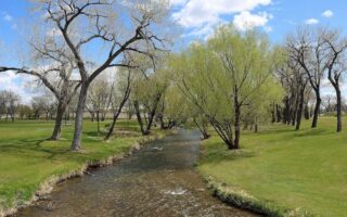
The “Swanny” Trail is a paved multi-use path which follows the Rapid Creek through Rapid City. Nearly the entire 8-mile trail forms a sort of linear park extending from downtown. Good loop options incorporating the major downtown parks.
A nice variety of trail running close to the center of Rapid City. Up to 12 miles of trail to choose from, but the Skyline Trail is a good option. Hilly!
A large dog and sporting park in the southeast part of Rapid City. The park features a playground, sporting fields, a BMX park, and a ~2 mile concrete loop trail.
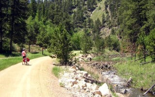
Wherever you go in the Black Hills, the Mickelson Trail is never far off. Hop on any section of this 108 mile rail trail for a fun out and back. The trail is mostly gravel but it's an easy, wide surface The trail map has excellent details on trail segments and distances.
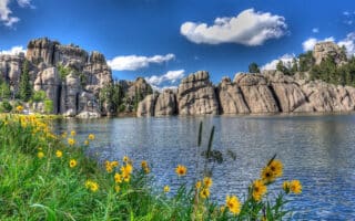
There are many trails to choose from in Custer State Park, but the easygoing trails around Sylvan Lake and the first couple of miles of the path toward Black Elk Peak are some of the best options for running.
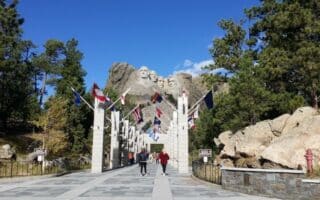
It’s a short novelty run, but the 1 mile “Presidential Trail” around Mount Rushmore offers great views of woodland scenery and the famous carvings.
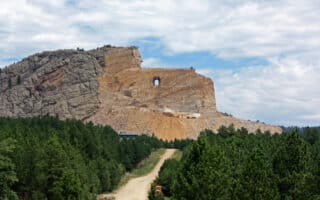
This Black Hills tourist attraction features a wide gravel road leading to the carving of a Lakota leader. Approximately 5 km out and back.
User Ratings
Leave A Review or Comment
Review or Comment on This Route/Share a Photo!
Share your feedback on this route and see that of other Great Runs users. Click on the image icon to upload a photo. And please let us know if there are notes or changes we should incorporate!