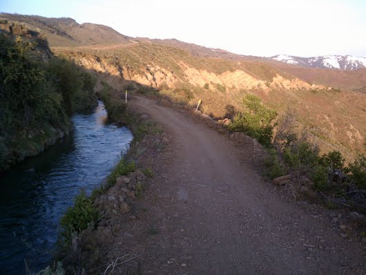
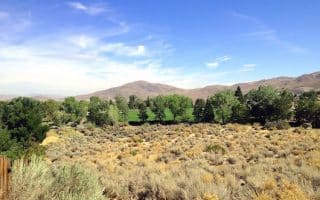
The Steamboat Ditch Trail is a wide, gravel path following an irrigation ditch that carries water from the Truckee River to the farms and ranches in the Reno area. It is one of the best spots in Reno for a longer off-road run, on rolling hills. There are excellent views of the mountain peaks and downtown Reno.
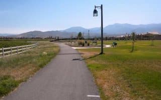
The trail begins at Horsemans Park, which is about 5 miles south of dowtown Reno. Follow the trail heading west of Skyline Blvd. The full trail is 6.3 miles one-way, or 12.7 miles out and back. Rt. 659 is at the 5-mile mark. The views of Verdi are very pretty as you head west. The total elevation gain for the full out and back is 830 feet, but the terrain is not steep.
The Steamboat Ditch Trail is a wide, gravel path following an irrigation ditch that carries water from the Truckee River to the farms and ranches in the Reno area. It is one of the best spots in Reno for a longer off-road run, on rolling hills. There are excellent views of the mountain peaks and downtown Reno.
The trail begins at Horsemans Park, which is about 5 miles south of dowtown Reno. Follow the trail heading west of Skyline Blvd. The full trail is 6.3 miles one-way, or 12.7 miles out and back. Rt. 659 is at the 5-mile mark. The views of Verdi are very pretty as you head west. The total elevation gain for the full out and back is 830 feet, but the terrain is not steep.


Review or Comment on This Route/Share a Photo!
Share your feedback on this route and see that of other Great Runs users. Click on the image icon to upload a photo. And please let us know if there are notes or changes we should incorporate!