Just west of Riverside/San Bernardino is Ontario, a city anchored by the area’s regional airport, Route 66, and Cucamonga-Guasti Regional Park. The best places to run in Ontario are several multi-use trails, some small parks, and trail running in the San Gabriel Mountains
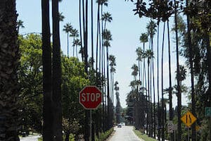
Pacific Electric Trail
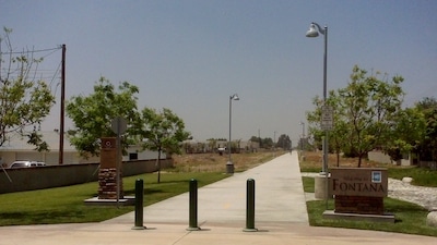
Pacific Electric Trail. This ‘Rails to Trails’ path trail runs for 20 miles between Claremont and Rialto. A good spot to catch the trail in central Ontario is the parking lot at the Route 66 Trailhead off Foothills Blvd. Some nice views of the San Gabriel Mountains. Part dirt, part gravel. Note: open and exposed. There are some drinking fountains along the way. ROUTE MAP
Cucamonga Creek Trail. This is a centrally located multi-use path in Ontario. It’s a good bet for those staying in the Airport/Convention Center area. The paved trail goes from E 4th St. at Cucamonga-Guasti Regional Park (just north of the Airport) north for 6.2 miles to E 24th St., just below the mountains. Good add-ons are trails in Cucamonga Regional Park & Red Hill Park (where it intersects w/the Pacific Electric Trail. ROUTE MAP
Add-Ons: Upland Trails. ~1.5 mile loop on trails off E 19th St., just below Foothills Fwy; Red Hill Park, ~1.3 miles out and back.
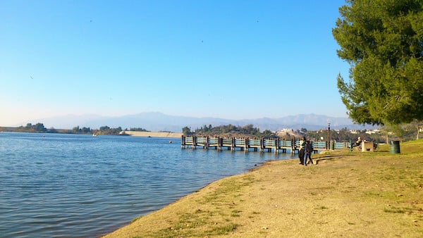
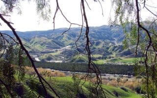
Puddingstone Reservoir/Bonelli Park. This artificial lake located 10 miles west of Ontario is one of the most scenic running options in the area. There are several 10+ miles of trails. We’ve mapped a 6.3 mile out and back route that includes a section along the eastern shore of the Reservoir, a loop around the Olen’s Cove Day area, and a section of the Bonelli Park Trail at the southern end of the lake. There’s a more remote, ‘trail running’ section of the Bonelli Park Trail just south of Via Verde Dr. ROUTE MAP
Just west of Riverside/San Bernardino is Ontario, a city anchored by the area’s regional airport, Route 66, and Cucamonga-Guasti Regional Park. The best places to run in Ontario are several multi-use trails, some small parks, and trail running in the San Gabriel Mountains
Pacific Electric Trail
Pacific Electric Trail. This ‘Rails to Trails’ path trail runs for 20 miles between Claremont and Rialto. A good spot to catch the trail in central Ontario is the parking lot at the Route 66 Trailhead off Foothills Blvd. Some nice views of the San Gabriel Mountains. Part dirt, part gravel. Note: open and exposed. There are some drinking fountains along the way. ROUTE MAP
Cucamonga Creek Trail. This is a centrally located multi-use path in Ontario. It’s a good bet for those staying in the Airport/Convention Center area. The paved trail goes from E 4th St. at Cucamonga-Guasti Regional Park (just north of the Airport) north for 6.2 miles to E 24th St., just below the mountains. Good add-ons are trails in Cucamonga Regional Park & Red Hill Park (where it intersects w/the Pacific Electric Trail. ROUTE MAP
Add-Ons: Upland Trails. ~1.5 mile loop on trails off E 19th St., just below Foothills Fwy; Red Hill Park, ~1.3 miles out and back.
Puddingstone Reservoir/Bonelli Park. This artificial lake located 10 miles west of Ontario is one of the most scenic running options in the area. There are several 10+ miles of trails. We’ve mapped a 6.3 mile out and back route that includes a section along the eastern shore of the Reservoir, a loop around the Olen’s Cove Day area, and a section of the Bonelli Park Trail at the southern end of the lake. There’s a more remote, ‘trail running’ section of the Bonelli Park Trail just south of Via Verde Dr. ROUTE MAP
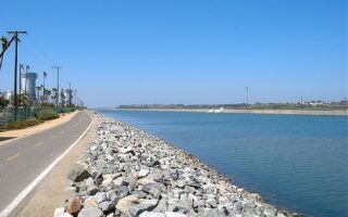
The best option for an easy longer distance off-road run in the Inland Empire. We've mapped the 20 mile section that runs between Riverside and San Bernardino. Some sections with parks and water views, other sections more sprawly & industrial.
A nice run with an optional hill climb in the series of parks just west of downtown. We've put together a 7.5 mile route incorporating Mt. Rubidoux Park, Fairmount Park, and Ryan Bonaminio Park. The Mt. Rubidoux climb is 1.2 miles, 320 foot gain.
Historic Victoria Ave. is the most scenic on-road running spot in the Riverside area. This divided scenic street is popular for its many trees and exotic plants used to landscape the route. It's up to 7.6 miles. Can do a 'loop' with Gage Canal Trail.
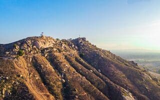
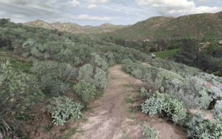
Scenic trail running with options for all abilities in Box Springs Mountain Reserve, Sycamore Canyon Wilderness Park, and trails in the Botanical Gardens of UC Riverside.
There are some scenic, easier trail running southeast of the San Bernardino in Blair Park, South Hills Preserve, San Timoteo Nature Sanctuary, & Herngt 'Aki' Preserve. Also the Orange Blossom multi-use trail in Redlands.
Share your feedback on this route and see that of other Great Runs users. Click on the image icon to upload a photo. And please let us know if there are notes or changes we should incorporate!

Review or Comment on This Route/Share a Photo!
Share your feedback on this route and see that of other Great Runs users. Click on the image icon to upload a photo. And please let us know if there are notes or changes we should incorporate!