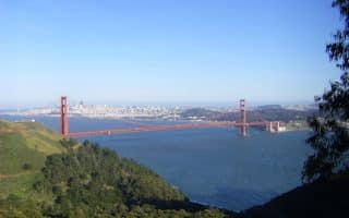
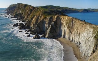
Great running in the tony town of Sausalito, located in Marin County across the Golden Gate Strait from San Francisco. It’s just over the Golden Gate Bridge, or can be reached by ferry from San Francisco. We’ve mapped a lovely waterfront run to Bayfront Park. Those who love hills and homes can explore the residential area.
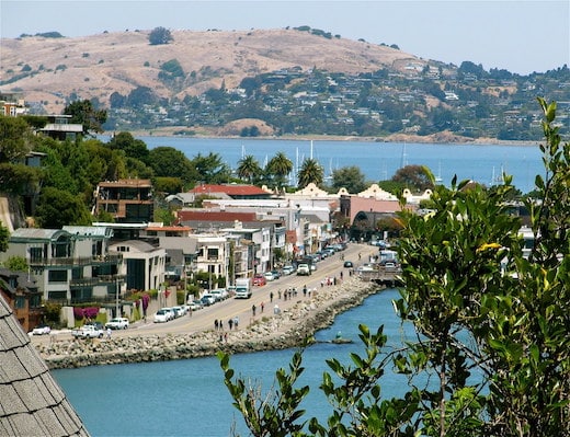
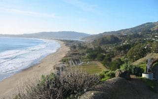
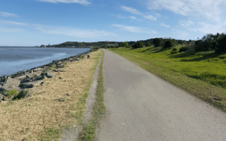
Waterfront Run: Start in the center of Sausalito on Bridgeway. Enjoy the great views of San Francisco on the right and the shops of downtown Sausalito on the left. Follow the waterfront road/path. Just past the 1-mile mark at Dunphy Park, join the paved Mill Valley-Sausalito multi-use path. Follow it along the water, passing several harbors and marinas. At the 3.7 mile park, there’s a pretty 1.3 mile section through the Bothin Marsh Preserve, to Bayfront Park. Our route ends here, but the path continues for another mile.
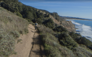
Residential Run: For those who want to see some great homes and waterfront views, we recommend exploring the residential area just above town. No set route here — just enjoy the quiet neighborhood streets, featuring an eclectic mix of homes. Note it is very hilly, but you’ll be rewarded with great views. There are two sections: between downtown Sausalito and Highway 101. And then, a larger (but less spectacular) residential area inland from Miller Ave.
Great running in the tony town of Sausalito, located in Marin County across the Golden Gate Strait from San Francisco. It’s just over the Golden Gate Bridge, or can be reached by ferry from San Francisco. We’ve mapped a lovely waterfront run to Bayfront Park. Those who love hills and homes can explore the residential area.
Waterfront Run: Start in the center of Sausalito on Bridgeway. Enjoy the great views of San Francisco on the right and the shops of downtown Sausalito on the left. Follow the waterfront road/path. Just past the 1-mile mark at Dunphy Park, join the paved Mill Valley-Sausalito multi-use path. Follow it along the water, passing several harbors and marinas. At the 3.7 mile park, there’s a pretty 1.3 mile section through the Bothin Marsh Preserve, to Bayfront Park. Our route ends here, but the path continues for another mile.
Residential Run: For those who want to see some great homes and waterfront views, we recommend exploring the residential area just above town. No set route here — just enjoy the quiet neighborhood streets, featuring an eclectic mix of homes. Note it is very hilly, but you’ll be rewarded with great views. There are two sections: between downtown Sausalito and Highway 101. And then, a larger (but less spectacular) residential area inland from Miller Ave.
Review or Comment on This Route/Share a Photo!
Share your feedback on this route and see that of other Great Runs users. Click on the image icon to upload a photo. And please let us know if there are notes or changes we should incorporate!