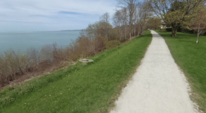
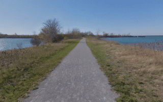
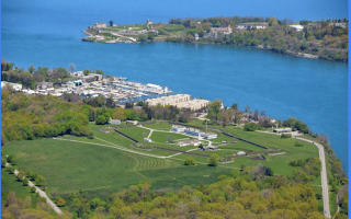
This is a very scenic run in neighborhood of Port Dalhousie in north St. Catharines, exploring several waterfront trails and parks. The full route is ~10 km, with options for longer or shorter. Start at Lakeside Park (large parking lot), situated on Lake Ontario. Enjoy an 0.5 km jaunt out to the pier, then a loop around the park. Head south along the Harbour Walkway Trail, a pretty trail with great water views crossing Martindale Pond to Royal Henley Park (site of a famous regatta) and Jaycee Gardens Park. Do a ~1.5 km loop of the parks, then retrace your steps to continue along the Harbour Walkway Trail, first to Lockhart Point, then on the eastern side of the canal along the Waterfront Trail for 1.5 km alongside the Marina, with views to the Port Dalhousie Range Rear Lighthouse, and then east along Lake Ontario to the end at Shore Blvd. Retrace your steps to the start.
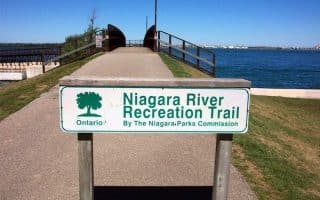
Add-Ons: The Waterfont Trail picks up again 2 km east of Shore Blvd., where we’ve also mapped a wonderful route along Lake Ontario and the Welland Canal. To connect to that, RIGHT on Lake St., LEFT on Lakeshore Rd., LEFT on Shoreline Blvd. These are pleasant residential streets.
This is a very scenic run in neighborhood of Port Dalhousie in north St. Catharines, exploring several waterfront trails and parks. The full route is ~10 km, with options for longer or shorter. Start at Lakeside Park (large parking lot), situated on Lake Ontario. Enjoy an 0.5 km jaunt out to the pier, then a loop around the park. Head south along the Harbour Walkway Trail, a pretty trail with great water views crossing Martindale Pond to Royal Henley Park (site of a famous regatta) and Jaycee Gardens Park. Do a ~1.5 km loop of the parks, then retrace your steps to continue along the Harbour Walkway Trail, first to Lockhart Point, then on the eastern side of the canal along the Waterfront Trail for 1.5 km alongside the Marina, with views to the Port Dalhousie Range Rear Lighthouse, and then east along Lake Ontario to the end at Shore Blvd. Retrace your steps to the start.
Add-Ons: The Waterfont Trail picks up again 2 km east of Shore Blvd., where we’ve also mapped a wonderful route along Lake Ontario and the Welland Canal. To connect to that, RIGHT on Lake St., LEFT on Lakeshore Rd., LEFT on Shoreline Blvd. These are pleasant residential streets.


Review or Comment on This Route/Share a Photo!
Share your feedback on this route and see that of other Great Runs users. Click on the image icon to upload a photo. And please let us know if there are notes or changes we should incorporate!