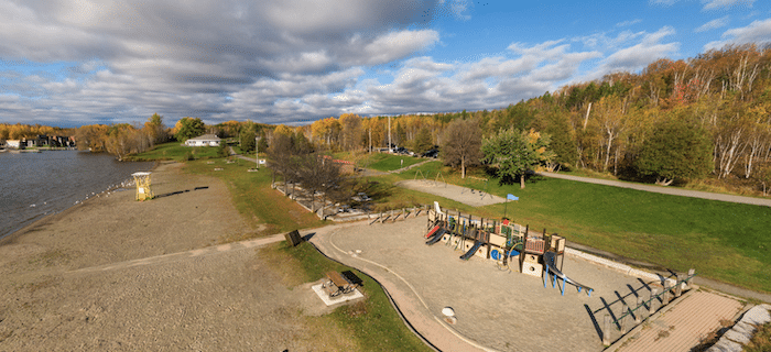
The Lake Laurentian Conservation Area is a great spot for trail running in the southeastern part of Greater Sudbury. There are many km of trails ranging from easy to moderate. There are scenic lookouts, lakes, wetlands, and woods. The more challenging trails are more rolling hills, with some tougher footing. There’s also a running track at the Outdoor Center, part of Laurentian University.
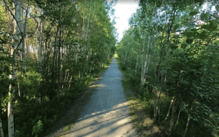
This trail map has excellent information on the trail options, with distances and difficulty ratings. Among the easier, straightforward options is 3 km Moonlight Beach Trail, which is a wide gravel path and part of the Trans Canada Trail. For challenge, the 4.2 km Point Trails require some climbing but offer some great views.
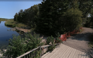
Bennett Lake Area. Just west of Laurentian Lake, there are additional trails in the Bennet Lake area. It’s a popular spot for nordic skiing in winter, but in summer the trails are open for walking, hiking, and trail running. A good connection point between the two areas is the running track at the outdoor center. Good running options include Loachs Trail on the north end of the lake and Sophie’s Loop on the south end.
The Lake Laurentian Conservation Area is a great spot for trail running in the southeastern part of Greater Sudbury. There are many km of trails ranging from easy to moderate. There are scenic lookouts, lakes, wetlands, and woods. The more challenging trails are more rolling hills, with some tougher footing. There’s also a running track at the Outdoor Center, part of Laurentian University.
This trail map has excellent information on the trail options, with distances and difficulty ratings. Among the easier, straightforward options is 3 km Moonlight Beach Trail, which is a wide gravel path and part of the Trans Canada Trail. For challenge, the 4.2 km Point Trails require some climbing but offer some great views.
Bennett Lake Area. Just west of Laurentian Lake, there are additional trails in the Bennet Lake area. It’s a popular spot for nordic skiing in winter, but in summer the trails are open for walking, hiking, and trail running. A good connection point between the two areas is the running track at the outdoor center. Good running options include Loachs Trail on the north end of the lake and Sophie’s Loop on the south end.


Review or Comment on This Route/Share a Photo!
Share your feedback on this route and see that of other Great Runs users. Click on the image icon to upload a photo. And please let us know if there are notes or changes we should incorporate!