Pickering is a city in the Durham Region, at the eastern end of the Greater Toronto area. The best place to run in Pickering is on the 11.5 km of paths on Lake Ontario headed east to Ajax. There’s also some nice running on paths along Duffins Creek.
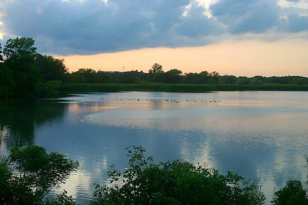
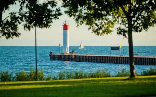
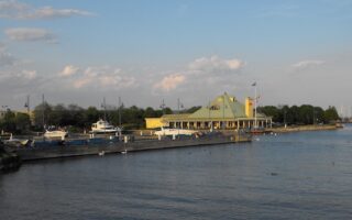
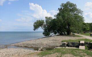
Lake Ontario Waterfront. This is some of the most scenic running in the GTA. A paved multi-use path runs for 11.5 km east from Pickering along Lake Ontario, with some terrific water views. The western end is at Beachfront Park, just across from Frenchman’s Bay. Run east for 1.5 km along the water, then slightly inland for 1.5 km. The path rejoins the water at Squires Beach, continuing east, passing Simcoe Point and Rotary Park [connect here to Trans Canada Trail along Duffins Creek] to Ajax Waterfront Park (7 km mark). From there, continue for another 2 km to Paradise Beach. Then there’s a 1.5 km loop away from Lake Ontario along Carruthers Marsh. Choose a section! ROUTE MAP
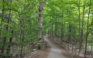
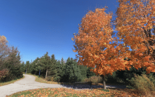
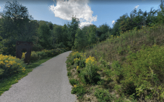
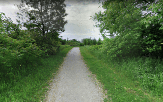
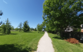
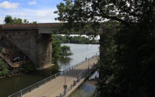
Trans Canada Trail Along Duffins Creek. There’s some pleasant running on a greenway along Duffins Creek, which straddles the Pickering/Ajax border. The trails are a combination of open and wooded terrain, mix of paved and gravel.
There are two sections of the Trans Canada trail here. A southern section starts at Rotary Park along the Waterfront Path and runs inland along the creek for 3.2 km. A northern section (not contiguous) starts just north of Highway 401, and runs north for 3.5 km north to Riverside Dr., where there’s a parking lot at the trailhead.
Pickering is a city in the Durham Region, at the eastern end of the Greater Toronto area. The best place to run in Pickering is on the 11.5 km of paths on Lake Ontario headed east to Ajax. There’s also some nice running on paths along Duffins Creek.
Lake Ontario Waterfront. This is some of the most scenic running in the GTA. A paved multi-use path runs for 11.5 km east from Pickering along Lake Ontario, with some terrific water views. The western end is at Beachfront Park, just across from Frenchman’s Bay. Run east for 1.5 km along the water, then slightly inland for 1.5 km. The path rejoins the water at Squires Beach, continuing east, passing Simcoe Point and Rotary Park [connect here to Trans Canada Trail along Duffins Creek] to Ajax Waterfront Park (7 km mark). From there, continue for another 2 km to Paradise Beach. Then there’s a 1.5 km loop away from Lake Ontario along Carruthers Marsh. Choose a section! ROUTE MAP
Trans Canada Trail Along Duffins Creek. There’s some pleasant running on a greenway along Duffins Creek, which straddles the Pickering/Ajax border. The trails are a combination of open and wooded terrain, mix of paved and gravel.
There are two sections of the Trans Canada trail here. A southern section starts at Rotary Park along the Waterfront Path and runs inland along the creek for 3.2 km. A northern section (not contiguous) starts just north of Highway 401, and runs north for 3.5 km north to Riverside Dr., where there’s a parking lot at the trailhead.
Review or Comment on This Route/Share a Photo!
Share your feedback on this route and see that of other Great Runs users. Click on the image icon to upload a photo. And please let us know if there are notes or changes we should incorporate!