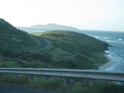
There is some wonderful running at the eastern end of St. Croix. One good option is East End Rd., which goes for 1.5 miles from Cramer Park to Point Udall. You’re above the water here, and the water views are fantastic. Note that this road has no shoulder, so extra caution is needed. There’s also a killer hill at the 1.6 km mark that goes for 0.8 km with grades up to 10%. Add-On: There’s a spur trail off East End Rd. that leads to the Isaac Scenic Overview and Isaac Bay, mainly downhill. A bit narrow, but runnable.
Jack Bay Trail. Source: https://www.uncommoncaribbean.com
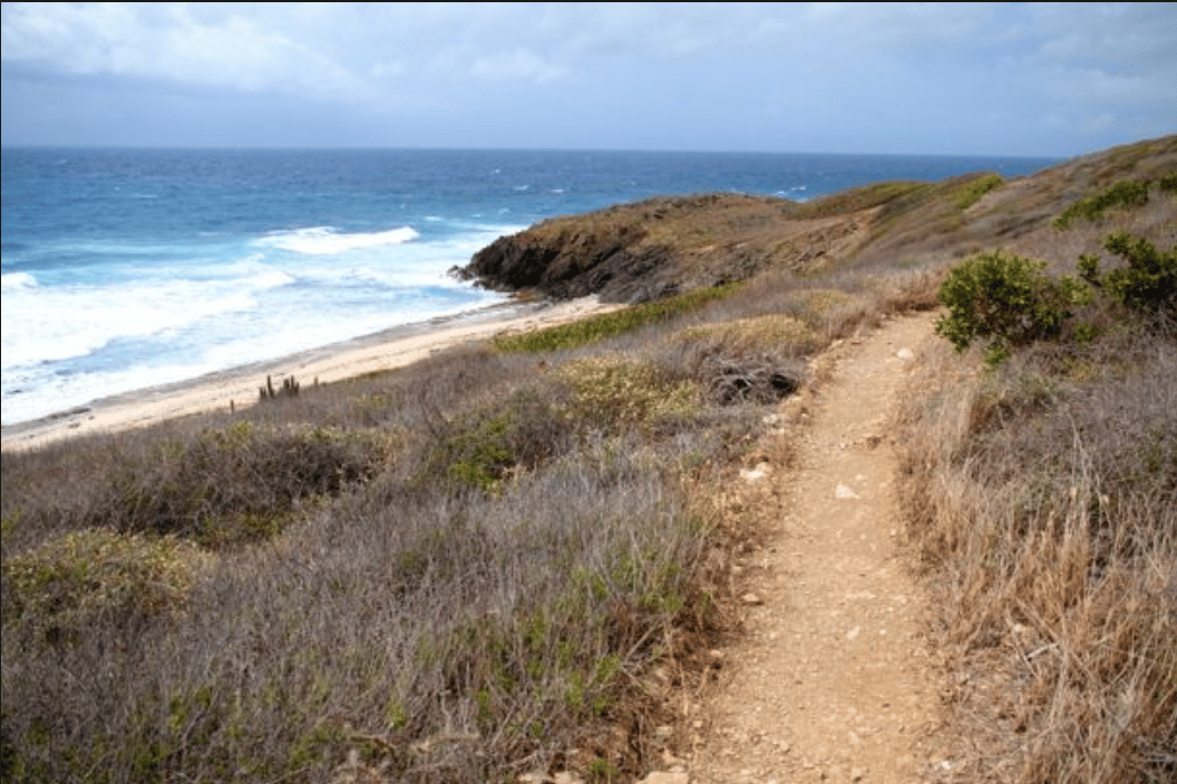
There is also some of the USVI’s most accessible and scenic trail running here. The Jack Bay Trail comes off East End Rd. at the Observatory and leads to the Jack and Isaac Bay Preserve. It is 1.2 miles to Jack Beach. It’s a gravel trail, wide enough for running, with some loose rock — but runnable. Note that the first 1 km is a killer hill — 600 feet, up to 17% grade. At Jack Beach, there are trails that head west to Hughes Point (0.3 miles) or to Isaac Bay (0.7 miles). Or, it’s 1 mile between Hughes Point and Isaac Bay — and this section is flatter. At Hughes Point, Point Rd./Grape Tree Rd. goes for 0.5-1 miles along a very pleasant coastal section. Great views, some open and some tall grass.
There is some wonderful running at the eastern end of St. Croix. One good option is East End Rd., which goes for 1.5 miles from Cramer Park to Point Udall. You’re above the water here, and the water views are fantastic. Note that this road has no shoulder, so extra caution is needed. There’s also a killer hill at the 1.6 km mark that goes for 0.8 km with grades up to 10%. Add-On: There’s a spur trail off East End Rd. that leads to the Isaac Scenic Overview and Isaac Bay, mainly downhill. A bit narrow, but runnable.
Jack Bay Trail. Source: https://www.uncommoncaribbean.com
There is also some of the USVI’s most accessible and scenic trail running here. The Jack Bay Trail comes off East End Rd. at the Observatory and leads to the Jack and Isaac Bay Preserve. It is 1.2 miles to Jack Beach. It’s a gravel trail, wide enough for running, with some loose rock — but runnable. Note that the first 1 km is a killer hill — 600 feet, up to 17% grade. At Jack Beach, there are trails that head west to Hughes Point (0.3 miles) or to Isaac Bay (0.7 miles). Or, it’s 1 mile between Hughes Point and Isaac Bay — and this section is flatter. At Hughes Point, Point Rd./Grape Tree Rd. goes for 0.5-1 miles along a very pleasant coastal section. Great views, some open and some tall grass.
Scroll Down For Route Maps
Essentials
Cramer Park to Point Udall: 5 km (3.1 miles) out and back; Jack Bay Trail is up to 7 km out and back w/Hughes Point/Isaac Bay
Cramer Park to Point Udall: 311 feet; Jack Bay Trail: 620 feet
Cramer Park or Point Udall. Jack Bay Trail comes off East End Rd. at Observatory
This run in Virgin Islands National Park is a bit off the beaten path, but it’s an interesting course which mixes paved roads, paths, and waterfront views. Francis Bay Trail is 6 km out and back, or 7.5 km when combined with the Johnny Horn Trail.
Trails in the USVI can be steep and rocky, but this 2.6 mile out and back route in Virgin Islands National Park from Cruz Bay up to Honeymoon Beach is one of the most runnable trails on St. John, and features great views.
A perfect course for anyone staying at or near the St. John Westin, Great Cruz Bay Road is a two mile (3.5 km) roller coaster of a paved street running along the rocky peninsula between Cruz Bay and Chocolate Hole.
The breezy 1.2 mile stretch along the Long Bay Waterfront is a rare opportunity to break away from the trails and narrow streets of the USVI and run along a nice paved walk which caters exclusively to pedestrians.
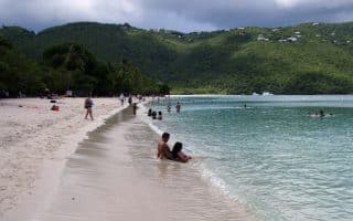
Magen's Bay is arguably the best beach for running on St. Thomas. About 1.5 miles (2.4 km) out and back on quite runnable sand, with a concrete path/road along the beach as an option.
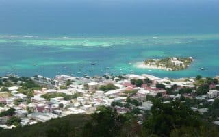
Town on the northern shore of St. Croix that offers some interesting history and some good running options. Run in town, around the National Historic Site, up the Christinansted Bypass road to an overlook with great views.
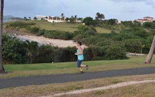
The Buccaneer Golf Course, in the Shoys area of St. Croix, may seem exclusive and inaccessible, but it is home to a public jogging track where runners can get in a good, and hilly 4 miles (6.4 km) away from the busy, narrow roads.
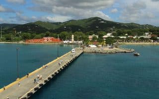
Located on the western end of St. Croix, the “Freedom City” of Frederiksted is a sleepy port town with a rich history and a fabulous 1 mile (1.6 km) long waterfront walkway, a pier, and a quiet road to Sandy Point Refuge.
Share your feedback on this route and see that of other Great Runs users. Click on the image icon to upload a photo. And please let us know if there are notes or changes we should incorporate!
Subscribe
0 Comments
Oldest
Newest
Inline Feedbacks
View all comments
Essentials
Cramer Park to Point Udall: 5 km (3.1 miles) out and back; Jack Bay Trail is up to 7 km out and back w/Hughes Point/Isaac Bay
Cramer Park to Point Udall: 311 feet; Jack Bay Trail: 620 feet
Cramer Park or Point Udall. Jack Bay Trail comes off East End Rd. at Observatory


Review or Comment on This Route/Share a Photo!
Share your feedback on this route and see that of other Great Runs users. Click on the image icon to upload a photo. And please let us know if there are notes or changes we should incorporate!