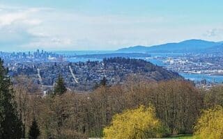
Surrey is a city of 500,000 that’s part of the Vancouver metro area, covering a large area between the Fraser River and the U.S. border. There are some excellent options for running in Surrey:
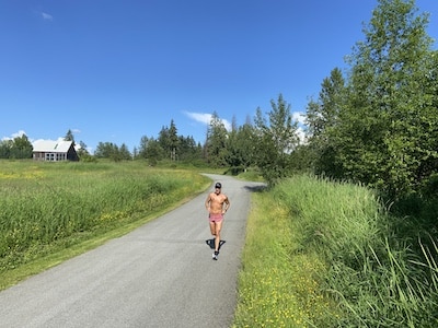
Tynehead Park. Paul Taylor
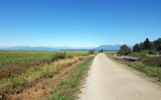
Tynehead Park. One of the best places to run in Surrey. A combination of paved and gravel trails. 168th St. divides the park into two sections. East of 168th St., the 4 km paved Perimeter trail is a good run, with more open terrain (MAP). On the west side, which is more for trail running, the 4 km Serpentine loop is a good option, featuring rolling hills and a walkway over the Serpentine River. Our thanks to Paul Taylor for suggesting this route!
Surrey Bend Regional Park. Located off 104th Ave., the 860-acre Surrey Bend Regional Park features several km of trails around wetlands. A loop of the perimeter is ~4.5 km. (MAP). Can combine with Barnston Island, reachable via a 5-minute ferry.
Barnston Island. Take the 5-minute ferry across to Barnston Island, and enjoy the running along nearly traffic-free Dyke Rd., which features great views of the Fraser River and the island’s farms. A loop of the island is 10 km. (MAP)
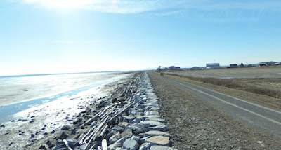
Boundary Bay path. Google Street View.
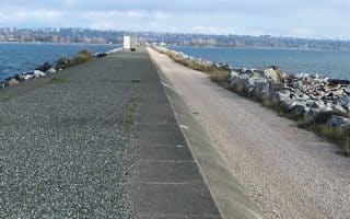
Boundary Bay Dyke Trail. A gravel trail along the north side of Boundary Bay. Wide open, with great water views. Up to 17 km between Mud Bay Park and Beach Grove in Tsawwassen.
Crescent Beach Area. In South Surrey, there’s scenic running in the Crescent Beach area. A 1.4 km gravel path runs along Boundary Bay, which can be combined with the paths around Blackie Spit (might be sandy) for a ~6 km route. Wonderful water views! (MAP)
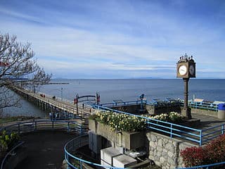
White Rock Pier. Creative Commons
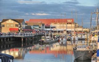
White Rock Promenade. The most scenic run in Surrey. Located in South Surrey near the U.S. border, the paved White Rock Promenade runs for 2.3 km along Boundary Bay, affording fantastic views. An out & back route, including the 0.4 km jaunt to the end of White Rock Pier, is 5.4 km. MAP
Surrey is a city of 500,000 that’s part of the Vancouver metro area, covering a large area between the Fraser River and the U.S. border. There are some excellent options for running in Surrey:
Tynehead Park. Paul Taylor
Tynehead Park. One of the best places to run in Surrey. A combination of paved and gravel trails. 168th St. divides the park into two sections. East of 168th St., the 4 km paved Perimeter trail is a good run, with more open terrain (MAP). On the west side, which is more for trail running, the 4 km Serpentine loop is a good option, featuring rolling hills and a walkway over the Serpentine River. Our thanks to Paul Taylor for suggesting this route!
Surrey Bend Regional Park. Located off 104th Ave., the 860-acre Surrey Bend Regional Park features several km of trails around wetlands. A loop of the perimeter is ~4.5 km. (MAP). Can combine with Barnston Island, reachable via a 5-minute ferry.
Barnston Island. Take the 5-minute ferry across to Barnston Island, and enjoy the running along nearly traffic-free Dyke Rd., which features great views of the Fraser River and the island’s farms. A loop of the island is 10 km. (MAP)
Boundary Bay path. Google Street View.
Boundary Bay Dyke Trail. A gravel trail along the north side of Boundary Bay. Wide open, with great water views. Up to 17 km between Mud Bay Park and Beach Grove in Tsawwassen.
Crescent Beach Area. In South Surrey, there’s scenic running in the Crescent Beach area. A 1.4 km gravel path runs along Boundary Bay, which can be combined with the paths around Blackie Spit (might be sandy) for a ~6 km route. Wonderful water views! (MAP)
White Rock Pier. Creative Commons
White Rock Promenade. The most scenic run in Surrey. Located in South Surrey near the U.S. border, the paved White Rock Promenade runs for 2.3 km along Boundary Bay, affording fantastic views. An out & back route, including the 0.4 km jaunt to the end of White Rock Pier, is 5.4 km. MAP
A great five mile out and back along the "jetty" in Iona Regional Park. Ocean views the whole way. Good spot for intervals! This is a good running option near Vancouver Airport, in Richmond. Note: can be windy.
Some excellent running options near Vancouver International Airport! The Middle Arm and West Dyle are gravel trails along the Fraser River & Strait of Georgia, with nice water & mountain views. Run separately or combine.
A couple of great running options in the cute village of Steveston, which is 20 min. from the Vancouver airport: A 10k tour of Steveston; and the scenic W Dyke Trail, including a loop of Gary Point Park
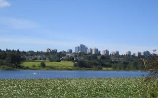
Burnaby is Vancouver’s major eastern suburb. The best running option in the area is the 6.3 mile path around Burnaby Lake. Burnaby Central Park is another great choice for running in East Vancouver.
Extensive trail running opportunities at Burnaby Mountain, with something for all abilities. It surrounds the SFU campus, which has a path around the perimeter road and a running track.
Terrific selection of parks & trails for running. A favorite is Town Centre Park, which includes a lake loop & running track. Mundy Park has several km of forested trails. Good trail running in the Westwood Plateau area & Minnekhada Regional Park.
The Traboulay PoCo Trail features 25 km of scenic running along the Coquitlam River & Pitt River in Port Coquitlam. Nice combination of river & wetland/marsh views, and woodlands. We've described several section. Trails also continue into Coquitlam.
For runners who want a challenge, the Coquitlam Crunch Trail is a thing to do! This paved & gravel trail rises 261m over 2.9 km, and includes 894 stairs over 300 continuous meters. It's a popular fitness challenge. Use caution on the way down!
Share your feedback on this route and see that of other Great Runs users. Click on the image icon to upload a photo. And please let us know if there are notes or changes we should incorporate!


Review or Comment on This Route/Share a Photo!
Share your feedback on this route and see that of other Great Runs users. Click on the image icon to upload a photo. And please let us know if there are notes or changes we should incorporate!