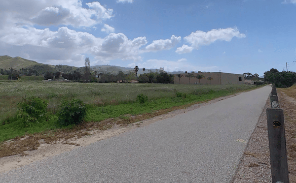
One of the best opportunities for a long off-road run north of Los Angeles is to choose a section of the Ventura River/Ojai Valley trail. A paved multi-use trail starts in downtown Ventura, and runs for 5.5 miles east to Foster Park, gently rising 200 feet. This section of the trail is called the Ventura River Trail (Ojai Valley Trail Extension). From Foster Park, the trail continues for another 6 miles through Casita Springs and Oakview, ending in Mira Monte. This section is a bit hillier with a slightly steeper grade.
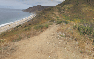
The terrain is a mix of open and exposed, with views of the hills surrounding the Ojai Valley, to some wooded and riverbed sections.
One of the best opportunities for a long off-road run north of Los Angeles is to choose a section of the Ventura River/Ojai Valley trail. A paved multi-use trail starts in downtown Ventura, and runs for 5.5 miles east to Foster Park, gently rising 200 feet. This section of the trail is called the Ventura River Trail (Ojai Valley Trail Extension). From Foster Park, the trail continues for another 6 miles through Casita Springs and Oakview, ending in Mira Monte. This section is a bit hillier with a slightly steeper grade.
The terrain is a mix of open and exposed, with views of the hills surrounding the Ojai Valley, to some wooded and riverbed sections.
Review or Comment on This Route/Share a Photo!
Share your feedback on this route and see that of other Great Runs users. Click on the image icon to upload a photo. And please let us know if there are notes or changes we should incorporate!