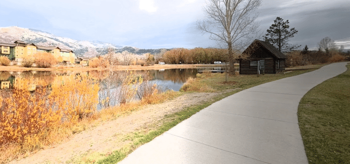
The Yampa River Core Trail is the heart of running in Steamboat Springs. The paved, fairly flat multi-use path runs for 6 miles along the Yampa River. It’s the best bet in Steamboat Springs for a longer, easier off-road run. There are several access points and a couple of spurs that add to the trail. TRAIL MAP
From downtown Steamboat Springs, the trail heads for 2 miles north or 4 miles south. The northern end is at the Bear River Skateboard Park off Lagoon Ct. The path heads south, through downtown, passing the Yampa River Botanic Park, ending at Stone Lane. There are water views some of the way, groves of cottonwood trees, and numerous picnic and fishing spots.
Add-Ons: At the southern end, connect to the 1-mile Walton Creek Trail, which continues to Whistler Park. In the downtown area, you can also connect to the Spring Creek Trail.


Review or Comment on This Route/Share a Photo!
Share your feedback on this route and see that of other Great Runs users. Click on the image icon to upload a photo. And please let us know if there are notes or changes we should incorporate!