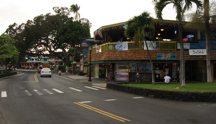
Alii Drive is far and wide the most popular running route in Kona, and perhaps on the whole Big Island. Our route goes from Kailua-Kona, at the intersection of Palani Drive, Alii Drive, and Kuakini Highway, then runs south along the coast with abundant ocean views for up to 7 miles one-way to near “The End of the World” — a good spot to check out volcanic rock and crashing waves. The first five miles are relatively flat, but the route gets pretty hilly from there on out. The run is so idyllic, it’s included in course for the Ironman World Championships. There is a nice wide shoulder for most of the way, and there are mile markers every ½ mile, so it’s easy to chart your progress. An added bonus: the route follows several beach parks with water and restroom facilities (approximately every 2 miles).
Features:
Categories:
Scroll Down For Route Maps
Essentials
- 7 miles one-way. Can turn around at any point!
- 289 feet (mostly miles 5-7)
- North End: Intersection of Palani Drive, Alii Drive, and Kuakini Highway
- Kuakini Highway or Palani Drive
Current Weather & Forecast

London, GB
4:27 pm,
Jun 12, 2026
L: 21°
H: 23°
Daily ForecastHourly Forecast
Today
10:00 pm
21° / 23°°C
0 mm
0%
21 mph
84 %
1002 mb
0 mm/h
Tomorrow
10:00 pm
28° / 33°°C
0 mm
0%
26 mph
87 %
1004 mb
0 mm/h
Sunday
10:00 pm
28° / 33°°C
0 mm
0%
24 mph
78 %
1005 mb
0 mm/h
Monday
10:00 pm
29° / 33°°C
0 mm
0%
22 mph
77 %
1004 mb
0 mm/h
Tuesday
10:00 pm
29° / 33°°C
0 mm
0%
20 mph
77 %
1004 mb
0 mm/h
Today
7:00 pm
29° / 29°°C
0 mm
0%
18 mph
82 %
1002 mb
0 mm/h
Today
10:00 pm
28° / 29°°C
0 mm
0%
21 mph
84 %
1002 mb
0 mm/h
Tomorrow
1:00 am
28° / 28°°C
0 mm
0%
22 mph
87 %
1002 mb
0 mm/h
Tomorrow
4:00 am
29° / 29°°C
0 mm
0%
25 mph
78 %
1004 mb
0 mm/h
Tomorrow
7:00 am
32° / 32°°C
0 mm
0%
26 mph
66 %
1004 mb
0 mm/h
Tomorrow
10:00 am
33° / 33°°C
0 mm
0%
26 mph
60 %
1002 mb
0 mm/h
Tomorrow
1:00 pm
31° / 31°°C
0 mm
0%
25 mph
68 %
1001 mb
0 mm/h
Other Routes in Hawaii "The Big Island," HI
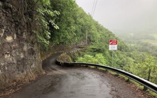
Run the steepest road in the United States! Waipiʻo Valley Road climbs 822 feet over 1.2 miles. Average grade 25%, topping out at 45%. STARTS at a fabulous lookout and goes downhill...then run back up!
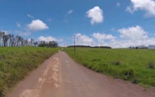
The red dirt Mana Road runs for over 40 miles heading out towards Mauna Kea volcano. Great views on this less trafficked road, which starts 2 miles west of Waimea Center. Hilly. Best bet is first 6 miles, near Waimea.
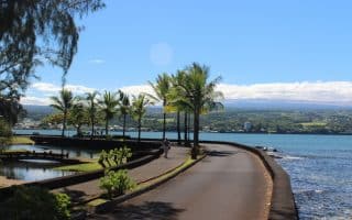
If you’re located near Hilo, on the eastern side of the island, the primo running spot is the beautiful Hilo bayfront, 3-5 miles of waterfront, including a 2 mile loop running under the shade of huge Banyan trees.
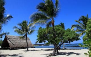
A solid two miles of sandy beach in the Hawaii Ocean Science and Technology Park near the airport. You can extend your mileage on the paved streets of the Natural Energy Lab or the trails of Kaloko-Honokohau National Historical Park.

A 6-mile, hilly out and back. Popular route for walking, jogging, biking along a less-trafficked road in the Holualoa area. Gains elevation until the turnaround point at Mile 3, then it’s a fun and fast downhill.
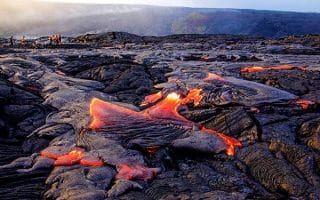
A one-of-a kind place. Hike or run the rim of an active crater, or run on trails or roads to enjoy terrain that includes deserts and rain forests, past craters and rift zones. We outline several good options. Note trail closures and air quality warnings!
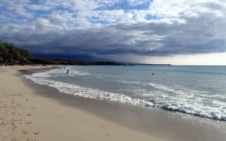
One of the largest swaths of white sand beach on Hawaii, and your best bet for a run on the sand. Combine with the Coastal Trail along the bluffs path to Mauna Key, for a fabulous 2.8 mile out and back.
User Ratings
Leave A Review or Comment
Review or Comment on This Route/Share a Photo!
Share your feedback on this route and see that of other Great Runs users. Click on the image icon to upload a photo. And please let us know if there are notes or changes we should incorporate!