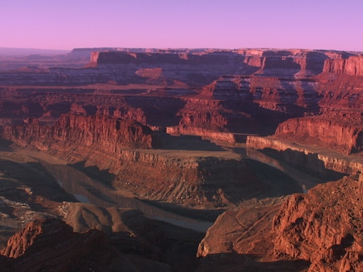
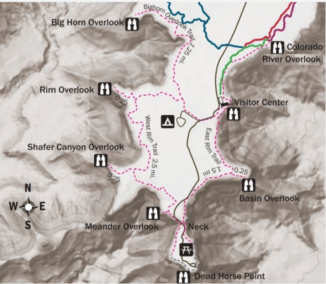
Dead Horse Point State Park features wonderful 360-degree views from its perch 2,000 feet above the Colorado River. We recommend this park as an ‘intro’ trail running spot, as its 7 miles of trails are are flatter and wider than many of the other trails in Moab. The signature run is the East Rim Trail between the Visitor Center and Dead Horse Point, which is a 3-mile out and back. Another option is to combine it with the West Rim Trail, making for a 4-mile loop. This link has details on the trails, including detailed descriptions. Note: elevation a factor here.Fee required.
Courtesy: Utah State Parks
Dead Horse Point State Park features wonderful 360-degree views from its perch 2,000 feet above the Colorado River. We recommend this park as an ‘intro’ trail running spot, as its 7 miles of trails are are flatter and wider than many of the other trails in Moab. The signature run is the East Rim Trail between the Visitor Center and Dead Horse Point, which is a 3-mile out and back. Another option is to combine it with the West Rim Trail, making for a 4-mile loop. This link has details on the trails, including detailed descriptions. Note: elevation a factor here.Fee required.
Scroll Down For Route Maps
Essentials
Various distance options depending on route chosen
The trails are generally not too hilly. West Rim Trail is hillier
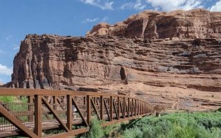
A great off-road option through beautiful scenery. We especially recommend the first 3 relatively flat miles of this paved pathway, from the pedestrian/bike bridge that crosses the Colorado River on Highway 128, to Arches Scenic Drive.
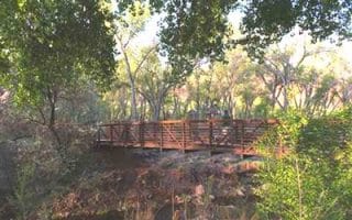
A pleasant flat and shaded option right in town. The paved 1.3 mile path runs from the center of town to Rotary Park, along Mill Creek. A nice way to see a bit of Moab. Bonus: nice running track near the trail head.
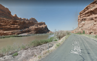
Very nice, flat running along the Colorado River near Moab. Wonderful water views and spectacular surrounding scenery. Kane Creek Blvd. is on the south side, Highway 279 on the north side...and no bridges for loop options...
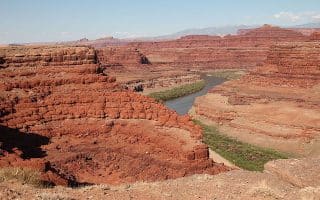
This area, near Moab, is a mecca for biking, hiking, climbing and other adventuring activities. Great running options in Canyonlands are Colorado River Overlook trail, Neck Springs, and a trail along Murphy Point Overlook.
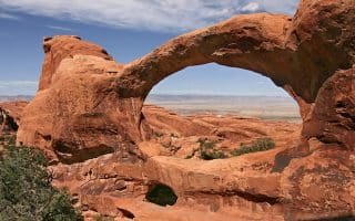
Along with Canyonlands NP, located in the outdoor recreational mecca around Moab, UT. For Arches, we recommend running the Landscape Arch, a nice 2-mile route starting at Devils Garden Trailhead. Arches Scenic Dr. is also runnable.
Share your feedback on this route and see that of other Great Runs users. Click on the image icon to upload a photo. And please let us know if there are notes or changes we should incorporate!
Subscribe
2 Comments
Oldest
Newest
Inline Feedbacks
View all comments
Essentials
Various distance options depending on route chosen
The trails are generally not too hilly. West Rim Trail is hillier

Review or Comment on This Route/Share a Photo!
Share your feedback on this route and see that of other Great Runs users. Click on the image icon to upload a photo. And please let us know if there are notes or changes we should incorporate!