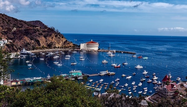
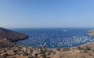
Avalon is home to 90% of Catalina Island’s 4,000 permanent residents, and is the landing point of ferries from the mainland. It is also the location of some of the easier and more accessible running options on Catalina Island. This map from the Island Spa is helpful. Some recommendations for routes, which can also be combined for longer runs.
East Coastal Run. The best option for a flat, coastal run in Avalon. A road/path, virtually car-free, runs for 2.5 miles between Descanso Bay (just past the Casino) south to the Southern California Edison Pebbly Beach Station. It’s a total of 2.5 miles one-way, or 5 miles out and back. The section from the Avalon Ferry to the Casino can be busy with people. For longer, do some ins and outs along Avalon’s side streets. ROUTE MAP
Mt. Ada/Wrigley Loop. For some fantastic views, we recommend Wrigley Rd. It’s 0.3 miles from town, using Clarissa Ave. or Lower Terrace Rd. to Clemente Ave. The first mile is a 400 foot climb (7-9% grades) on a car-free paved road, with three designated scenic overlooks and the Inn at Mt. Ada. Do a there and back or use Pebbly Beach Rd. along the coast for a 3.5 mile loop. Extend on the coast for 1 mile past town center on Casino Way for a longer run (so, 5.5 miles total). ROUTE MAP
Botanical Gardens. Another easy-to-follow route featuring a pretty road from Avalon center to the Wrigley Botanical Gardens, and looping around the Catalina Island Golf Course. Take Metropole to Tremont or Sumner out of town, then follow Avalon County Rd. on the north side of the golf course. Reach the Bird Park in 0.8 miles and the Botanical Garden in 1.6 miles. It’s a moderate climb, 400 feet at 3% grade. For the loop back, a horse trail runs along the southern end of the golf course and is popular with runners. ROUTE MAP
Catalina Chimes. Another good option from town center, is the moderate climb to the Catalina Chimes Tower. The loop incorporating Chimes Tower Rd. and Stagecoach Rd. is 2.3 miles, with numerous options to extend (see above routes). MAP.
Review or Comment on This Route/Share a Photo!
Share your feedback on this route and see that of other Great Runs users. Click on the image icon to upload a photo. And please let us know if there are notes or changes we should incorporate!