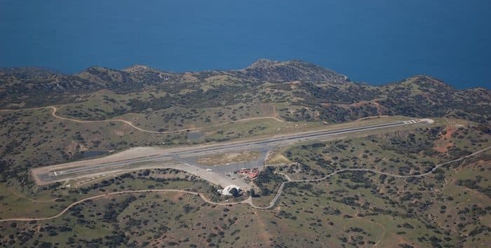
A paved road runs for 10 miles from Avalon to the ‘Airport in the Sky’, and makes for a terrific — and challenging — run. The airport sits at 1500 feet. It’s a gorgeous route, with great views of the coast for the first few miles from town and then winding around grassy hills. If running from town, use Stagecoach Rd. and note the first 3 miles is A VERY STEEP CLIMB. Then, the route flattens out. One option is to to take the airport shuttle to the airport (must be reserved), and run the route one-way downhill. ROUTE MAP
If running from the Airport, follow Airport Rd. for 7.3 miles to Stagecoach Rd., and then follow Stagecoach into town.
Additional Option. Run over to the Wrigley Botanical Garden and then into town. This adds some mileage but is pretty. At the intersection of Airport Rd. & Stagecoach Rd., take Divide Rd. (dirt road) heading south, to the Wrigley Garden. Then follow Avalon Cyn Rd. into town.


Review or Comment on This Route/Share a Photo!
Share your feedback on this route and see that of other Great Runs users. Click on the image icon to upload a photo. And please let us know if there are notes or changes we should incorporate!