Features:
Categories:
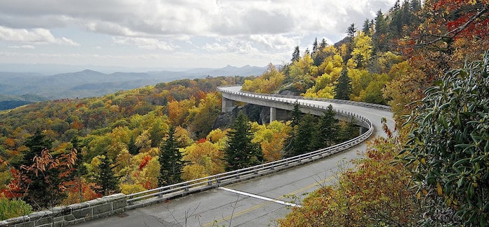
The Blue Ridge Parkway is a National Parkway, administered by the National Park Service, connecting Shenandoah National Park in Virginia to Great Smoky Mountains National Park in North Carolina. This 469-mile scenic road features stunning long-range vistas and close-up views of the rugged mountains and pastoral landscapes of the Appalachian Highlands. From a running perspective, the Parkway was designed primarily as a motorway — there’s no shoulder — so running along the parkway must be done with extreme caution. Also, it’s hilly!!
Our guide to running the Blue Ridge Park has three elements: The Parkway itself, some of the more runnable hiking trails, and the Moses Cone Park Carriage Trails, which are the absolute running highlight. More advanced trail runners should consult the hiking trails links for more challenging options.
Running the Parkway. The Parkway doesn’t have a shoulder, and there can be a lot of cars — and RVs — especially in season. If you wan to run on a section of the Parkway, we suggest going very early, especially in season. Note also that many sections are hilly. Here are the hilliest sections.
Hiking Trails Good for Running. There are 369 miles of hiking trails along the BRP. Many of them strenuous, with hills and challenging terrain. We’ve researched some of the trails of at least 2 miles in length and rated as easy-to-moderate. Several are horse trails (pedestrians permitted) or old fire roads. See this table for details, using the mile markers as a guide. TABLE OF RUNNABLE HIKING TRAILS
For more details and additional options:
- Hiking Trails, Virginia. Mileposts 0-213.
- Hiking Trails, North Carolina. Mileposts 213-469
Moses Cone Park Carriage Trails. This is the best option for easier, longer-distance running along the Parkway. Located at Milepost 294, Moses Cone Park features 25 miles of interconnected carriage trails. They’re wide and have a smooth gravel surface. Some are flat, others moderately hilly. Two of the most popular departure points are Flat Top Manor and Bass Lake. A few good route suggestions: TRAIL MAP
- Flat Top Manor to Bass Lake: 5 miles RT. Flat, smooth, lake views most of the way.
- Other suggestions from the National Park Service
Shenandoah National Park/Skyline Drive.
At the northern terminus of the Blue Ridge Parkway (I-64) is the southern end of Skyline Drive, and the entrance to Shenandoah National Park. See our guide to running there.


Comment on this Route/Share a Photo!
Share your feedback on this route and see that of other Great Runs users. Click on the image icon to upload a photo. And please let us know if there are notes or changes we should incorporate!