Singapore boasts some of the best running options near an airport of any city we know. There are several options here. Our thanks to Joylin Nodwell for some of these route suggestions. Bonus: All these paths are lit.
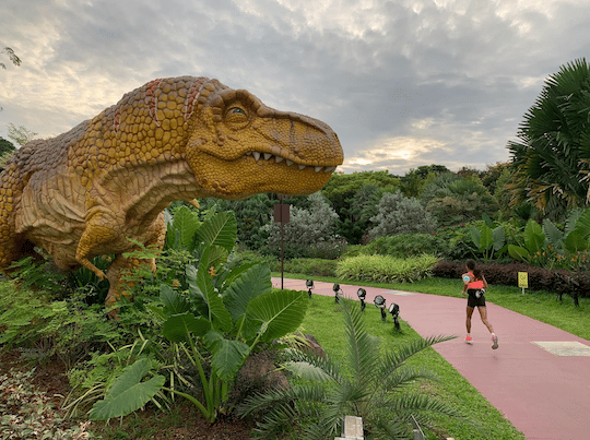
Jurassic Mile: Up to 4 km one-way. If you have a layover, this is the run for you! This relatively new route is a red coloured path that passes by 20 life-sized outdoor dinosaurs over 1 km. The path continues along the coast, with only one road crossing, to connect to the East Coast Park path. Total is 4 km from the airport to East Coast Park.
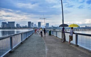
Changi Beach Park. CC: Edwin.11
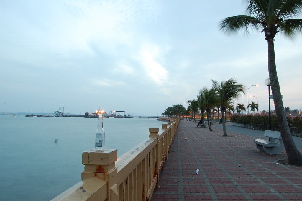
Changi Beach Park. Up to 7 km one-way. This is a pleasant off-road run mainly along the coast to Changi Beach. From Aviation Park Road, run on the paved path for 2 km to Changi Bay Point. There are lovely water views. Continue on the paved palm-lined path paralleling Changi Coast Rd., to Changi Beach and Changi Beach Park on the Changi Coast Track. It’s up to 7 km one-way.
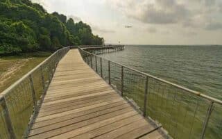
Pasir Ris Park. CC: cattan2011
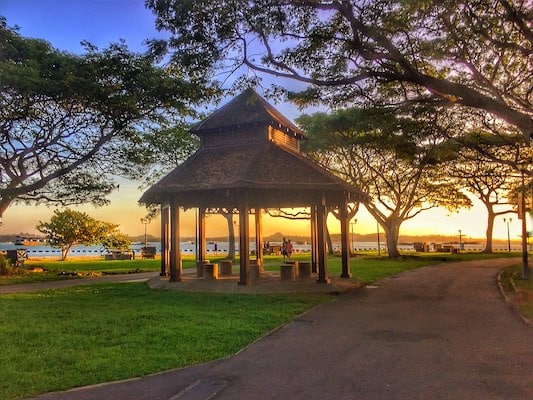
Pasir Ris Park and Tampines. Northeast of Changi Airport, there are several parks with pleasant jogging paths in the Pasir Ris and Tampines planning/residential areas. There are many paths, so it’s hard to designate a specific route. One can easily do a 15k run here!
Pasir Ris Park. This park is 3.5 km from east to west, passing through four ‘areas’. Palm-lined, with nice landscaping and water views. Area 1 is the Costa Lawn, Area 2 features a maze park & bird watching tower, and Area 3 follows Pasir Ris Beach.
South to Pasir Ris Town Park & Tampines. Up to 4.5 km one-way. This is another series of paths that can be combined with the above. From Area 1 of Pasir Ris Park, follow the paths south along the canal for 1 km to Pasir Ris Town Park, which features additional trails and a fishing park . Continue south for 1 km to Tampines Eco Green, a nice open space with grassy paths. Continue south into Sun Plaza Park.
Singapore boasts some of the best running options near an airport of any city we know. There are several options here. Our thanks to Joylin Nodwell for some of these route suggestions. Bonus: All these paths are lit.
Jurassic Mile: Up to 4 km one-way. If you have a layover, this is the run for you! This relatively new route is a red coloured path that passes by 20 life-sized outdoor dinosaurs over 1 km. The path continues along the coast, with only one road crossing, to connect to the East Coast Park path. Total is 4 km from the airport to East Coast Park.
Changi Beach Park. CC: Edwin.11
Changi Beach Park. Up to 7 km one-way. This is a pleasant off-road run mainly along the coast to Changi Beach. From Aviation Park Road, run on the paved path for 2 km to Changi Bay Point. There are lovely water views. Continue on the paved palm-lined path paralleling Changi Coast Rd., to Changi Beach and Changi Beach Park on the Changi Coast Track. It’s up to 7 km one-way.
Pasir Ris Park. CC: cattan2011
Pasir Ris Park and Tampines. Northeast of Changi Airport, there are several parks with pleasant jogging paths in the Pasir Ris and Tampines planning/residential areas. There are many paths, so it’s hard to designate a specific route. One can easily do a 15k run here!
Pasir Ris Park. This park is 3.5 km from east to west, passing through four ‘areas’. Palm-lined, with nice landscaping and water views. Area 1 is the Costa Lawn, Area 2 features a maze park & bird watching tower, and Area 3 follows Pasir Ris Beach.
South to Pasir Ris Town Park & Tampines. Up to 4.5 km one-way. This is another series of paths that can be combined with the above. From Area 1 of Pasir Ris Park, follow the paths south along the canal for 1 km to Pasir Ris Town Park, which features additional trails and a fishing park . Continue south for 1 km to Tampines Eco Green, a nice open space with grassy paths. Continue south into Sun Plaza Park.
Scroll Down For Route Maps
Essentials
Jurassic Mile to East Coast Park is 4 km; Changi Beach Path is up to 7 km one-way; Pasir Ris Park area has ~10 km of paths
Generally flat
Depends on route chosen
Subway: Tampines East for the Tampines/Pasir Park paths
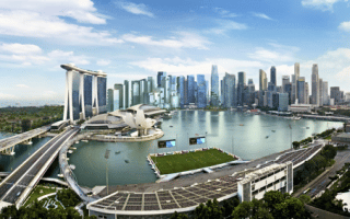
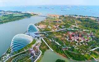
Gardens by the Bay is one of Singapore’s major sites and also great for running. Combine with Fort Canning Park for a hill and a great 5.8 mile tour, and even more with Marina Bay. The Helix Bridge is a highlight, as are numerous other pedestrian bridges.
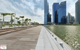
One of the most popular runs in Singapore. A paved multi-use path runs along the Singapore Strait from Marine Parade/Katong east toward the airport. Nice foliage, water views, and a festive scene. Up to 11.7 k one-way.
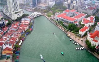
In the Punggol area in the northeastern part of Singapore, there's some very scenic running on waterfront paths, around Serangoon (Coney) Island, and Waterway Park. A few different distance options.
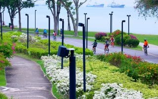
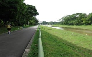
This 62-hectare city park the heartland of the Bishan and Ang Mo Kio residential districts is a nice place for a run. Paved trails wind through gardens and lawns for a ~6.4 km loop. Can extend w/trail along Kallang River.
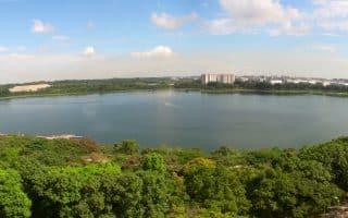
4.3 km loop around a Reservoir, which was originally a sand quarry. Popular spot in the eastern part of Singapore, near the airport. Add on with up to 3.4 km in adjacent Bedok Park
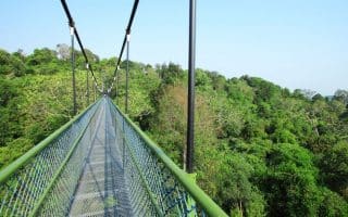
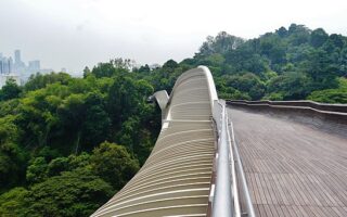
A verdant, scenic and unique run! Paths connect four adjacent parks, passing through and above a lush tree canopy, with great views of the city below. Includes two 'treetop walks' and impressive pedestrian bridges.
Pleasant 5 km path along the Pandan River, from Buona Vista MRT station to Clementi Ave. Can add with Rail Corridor Trail, which heads north to Clementi Forest & Bukit Timah.
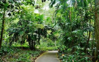
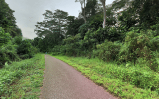
This 163-ha preserve 12 km from the city is a great trail running option. Lush vegetation, facilities, and trails of varying distances & difficulty, including the 163m Bukit Timah Hill.
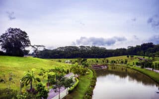
This 90-acre green oasis in the emerging Jurong Lake District is a wonderful new addition to the Singapore running scene. Run on lush trails through four themed gardens. Free and open all day. Lit at night!
A 16 km+ multi-use path in the western part of Singapore that can be run standalone or as add-on/connector to our Bukit Timah, Pandan River Trail, & Clementi Forest routes.
A scenic run in Woodlands - a planned residential community in the northern part of Singapore. Includes Woodlands Waterfront Park along the Johor Straits, and lush green trails through Marsiling Park and Admiralty Park.
For a scenic destination run, take the short ferry ride from Changi Point to Pulau Ubin Island. The island is a large nature sanctuary featuring wetlands, quarries, mangrove swamps, and lush woodlands. Some easier trails, others more rugged.
Share your feedback on this route and see that of other Great Runs users. Click on the image icon to upload a photo. And please let us know if there are notes or changes we should incorporate!
Subscribe
0 Comments
Oldest
Newest
Inline Feedbacks
View all comments
Essentials
Jurassic Mile to East Coast Park is 4 km; Changi Beach Path is up to 7 km one-way; Pasir Ris Park area has ~10 km of paths
Generally flat
Depends on route chosen
Subway: Tampines East for the Tampines/Pasir Park paths


Review or Comment on This Route/Share a Photo!
Share your feedback on this route and see that of other Great Runs users. Click on the image icon to upload a photo. And please let us know if there are notes or changes we should incorporate!