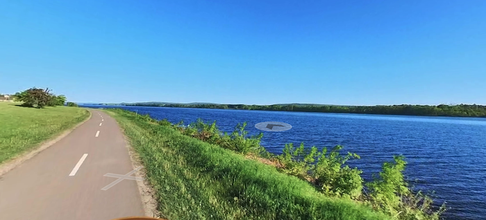
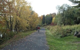
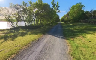
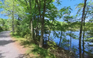
The Riverfront Trails are our favorite run in Fredericton. Paved multi-use paths run along both banks of the St John River, aptly named the North and South Riverfront Trails. There are great water views along most of both trails. The 0.6 km Bill Thorpe Walking Bridge connects both banks, and the Westmoreland Street Bridge also has a good pedestrian path. Note: Trails are maintained in winter.
N Riverfront Trail. Runs for 4.2 km between the Bill Thorpe Bridge and Main St. Some sections gravel.
S Riverfront Trail. Runs for 4.1 km between Morell Park to just past Wilmot Park.
Loop Options: It’s 2.2 km between the Bill Thorpe Bridge and Westmoreland Bridge.
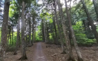
Add-Ons: From the N Riverfront Trail, the Northside Trail runs for 9 km through residential parts of Fredericton. Connect to it just off the Thorpe Bridge. Also off the Thorpe Bridge, you can connect to the Nashwaak Trail, which runs for 6.5 km north alongside a tributary of the St John River.
The Riverfront Trails are our favorite run in Fredericton. Paved multi-use paths run along both banks of the St John River, aptly named the North and South Riverfront Trails. There are great water views along most of both trails. The 0.6 km Bill Thorpe Walking Bridge connects both banks, and the Westmoreland Street Bridge also has a good pedestrian path. Note: Trails are maintained in winter.
N Riverfront Trail. Runs for 4.2 km between the Bill Thorpe Bridge and Main St. Some sections gravel.
S Riverfront Trail. Runs for 4.1 km between Morell Park to just past Wilmot Park.
Loop Options: It’s 2.2 km between the Bill Thorpe Bridge and Westmoreland Bridge.
Add-Ons: From the N Riverfront Trail, the Northside Trail runs for 9 km through residential parts of Fredericton. Connect to it just off the Thorpe Bridge. Also off the Thorpe Bridge, you can connect to the Nashwaak Trail, which runs for 6.5 km north alongside a tributary of the St John River.

Review or Comment on This Route/Share a Photo!
Share your feedback on this route and see that of other Great Runs users. Click on the image icon to upload a photo. And please let us know if there are notes or changes we should incorporate!