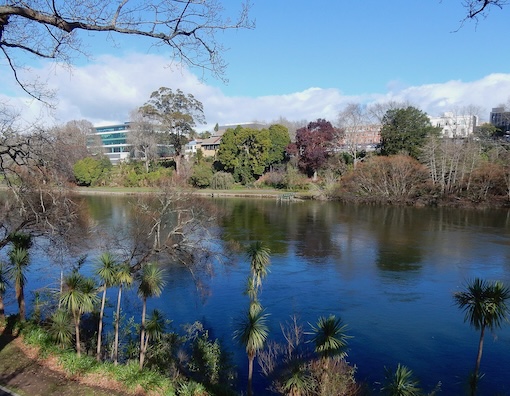
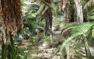
The paths (tracks) along the Waikato River are among the best places to run in Hamilton. There are scenic paths along both banks of the river, and seven bridges that can be crossed, making for all sorts of distance and loop options. The most continuous, developed path is along the west bank. Along the east bank, the path is less continuous, but there are some nice section.
West Bank Path. The Waikato River Walk is a paved multi-use path that runs for 17 km along the west bank of the river, between the Cobham Bridge near the Hamilton Gardens and the Horotiu Bridge north of Pukete. It’s also easily accessible from Hamilton Central (Anzak Br./Claudelands Br.). It’s park-like with good river views most of the way, and some wooded sections. There’s a ~2 km on-road section just north of Pukete Farm Park.
While the River Walk ends at Horotiu Bridge, there’s a cycle bridge to the eastern bank of the river, where the Te Awa River Trail picks up for another 7.5 km along the Waikato to Ngaruawahia. Run along the east bank for 2.5 km, cross the Perry Cycle Bridge, and continue along the west bank for another 5 km. There’s a great view at Ngaruawahia Point.
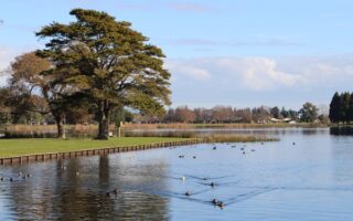
East Bank Path. The paths along the east bank are less continuous. The best sections are in the area of Day’s Park & Donny Park (additional paths in the parks) and for 2 km from the Anzac Bridge south to the Cobham Bridge @Hamilton Gardens.
Hamilton Central Loop Option. We’ve mapped an 8-9 km loop option in the area of Hamilton Central, combining the east & west banks of the Waikato River paths and some parks. Start at Anzac Parade and run south for 2 km to the Cobham Bridge. Then, do a ~3 km loop around Peacockes Reserve Esplanade & Sandford Park. Cross the Cobham Bridge to the east side of the Waikato and run north. We’ve included a ~1 km loop around Parana Park, which features Kōwhai trees and interactive native bird sculptures.
The paths (tracks) along the Waikato River are among the best places to run in Hamilton. There are scenic paths along both banks of the river, and seven bridges that can be crossed, making for all sorts of distance and loop options. The most continuous, developed path is along the west bank. Along the east bank, the path is less continuous, but there are some nice section.
West Bank Path. The Waikato River Walk is a paved multi-use path that runs for 17 km along the west bank of the river, between the Cobham Bridge near the Hamilton Gardens and the Horotiu Bridge north of Pukete. It’s also easily accessible from Hamilton Central (Anzak Br./Claudelands Br.). It’s park-like with good river views most of the way, and some wooded sections. There’s a ~2 km on-road section just north of Pukete Farm Park.
While the River Walk ends at Horotiu Bridge, there’s a cycle bridge to the eastern bank of the river, where the Te Awa River Trail picks up for another 7.5 km along the Waikato to Ngaruawahia. Run along the east bank for 2.5 km, cross the Perry Cycle Bridge, and continue along the west bank for another 5 km. There’s a great view at Ngaruawahia Point.
East Bank Path. The paths along the east bank are less continuous. The best sections are in the area of Day’s Park & Donny Park (additional paths in the parks) and for 2 km from the Anzac Bridge south to the Cobham Bridge @Hamilton Gardens.
Hamilton Central Loop Option. We’ve mapped an 8-9 km loop option in the area of Hamilton Central, combining the east & west banks of the Waikato River paths and some parks. Start at Anzac Parade and run south for 2 km to the Cobham Bridge. Then, do a ~3 km loop around Peacockes Reserve Esplanade & Sandford Park. Cross the Cobham Bridge to the east side of the Waikato and run north. We’ve included a ~1 km loop around Parana Park, which features Kōwhai trees and interactive native bird sculptures.


Review or Comment on This Route/Share a Photo!
Share your feedback on this route and see that of other Great Runs users. Click on the image icon to upload a photo. And please let us know if there are notes or changes we should incorporate!