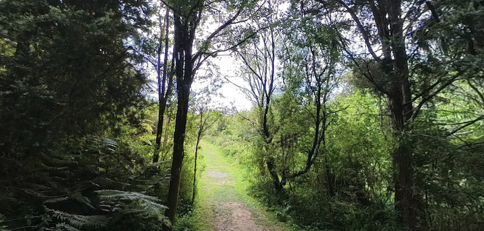
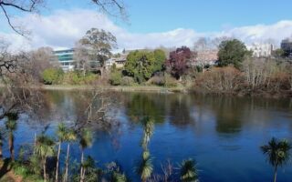
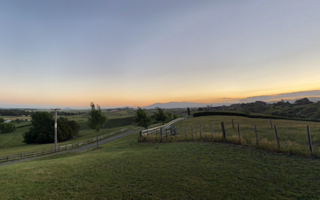
This is a verdant run in the Mt. Hakarimata area, located 10 km north-west of Hamilton. The Reserve features 1850 ha of protected forest, with options for both easier running and more challenging, hilly trail running. Overall, there are ~15 km of walking & hiking tracks passing through lush forest of kauri and beech trees. This brochure has excellent information on the trail options & distances.
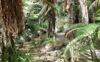
Easier Run: Hakarimata Rail Trail. This dirt trail/walkway traverses for 1.5 km through lowland forest from the entrance @Clark Rd. to the Cascades. Decent footing and fairly flat. 3 km out & back.
Path/Stairs to Summit. For a challenging climb to the summit on a trail with easier footing, take the #5 trail from Brownlee Ave. It’s a 2 km out & back, climbing 335m, including 1,349 wooden steps! To make this a longer run, take Waingaro Rd. for 1.5 km to the Rail Trail. [note: narrow/soft shoulder]. This would combine for 8 km.
Hakarimata Walkway & Summit Loop. This is a challenging, hill trail run. The Hakarimata Walkway is a 12 km hiking trail traversing the ridge of the Hakarimata Range. We’ve put together a nearly 8 km loop combining the 1.5 km Rail Trail, a 3 km section of the Hakarimata Walkway to the Hakarimata Summit Tower [note: 300m challenging climb!], and then an easier loop back through the Dam & Waterworks Park and along Waingaro Rd.
This is a verdant run in the Mt. Hakarimata area, located 10 km north-west of Hamilton. The Reserve features 1850 ha of protected forest, with options for both easier running and more challenging, hilly trail running. Overall, there are ~15 km of walking & hiking tracks passing through lush forest of kauri and beech trees. This brochure has excellent information on the trail options & distances.
Easier Run: Hakarimata Rail Trail. This dirt trail/walkway traverses for 1.5 km through lowland forest from the entrance @Clark Rd. to the Cascades. Decent footing and fairly flat. 3 km out & back.
Path/Stairs to Summit. For a challenging climb to the summit on a trail with easier footing, take the #5 trail from Brownlee Ave. It’s a 2 km out & back, climbing 335m, including 1,349 wooden steps! To make this a longer run, take Waingaro Rd. for 1.5 km to the Rail Trail. [note: narrow/soft shoulder]. This would combine for 8 km.
Hakarimata Walkway & Summit Loop. This is a challenging, hill trail run. The Hakarimata Walkway is a 12 km hiking trail traversing the ridge of the Hakarimata Range. We’ve put together a nearly 8 km loop combining the 1.5 km Rail Trail, a 3 km section of the Hakarimata Walkway to the Hakarimata Summit Tower [note: 300m challenging climb!], and then an easier loop back through the Dam & Waterworks Park and along Waingaro Rd.

Review or Comment on This Route/Share a Photo!
Share your feedback on this route and see that of other Great Runs users. Click on the image icon to upload a photo. And please let us know if there are notes or changes we should incorporate!