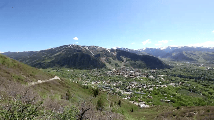
This Forest Service “trail” is actually an old mining road which climbs 6.3 miles out to the beautiful Warren Lakes. While it’s possible to run the whole length of the road out and back, the final section is quite steep. Many runners choose to take on the most popular section, which is 1.5 miles from the parking area at the base of the trailhead up to the Smuggler Mountain Overlook. Past that, the trail gets steeper and more challenging. This Forest Service trail description is helpful.
Ed Schipul
Features:
Scroll Down For Route Maps
Essentials
- Most 'runnable' section is 3 miles out and back from the parking lot to the Smuggler Mountain Overlook; Entire trail is 6 miles one-way
- 2873 feet (entire trail)
- Mollie Gibson Park
- Park Circle
Current Weather & Forecast

Aspen, US
3:28 am,
Jul 22, 2026
L: 15°
H: 15°
Daily ForecastHourly Forecast
Today
3:00 pm
13° / 29°°C
0 mm
0%
6 mph
87 %
1019 mb
0 mm/h
Tomorrow
3:00 pm
15° / 31°°C
0 mm
0%
21 mph
75 %
1016 mb
0 mm/h
Friday
3:00 pm
14° / 28°°C
0 mm
0%
16 mph
84 %
1011 mb
0 mm/h
Saturday
3:00 pm
14° / 28°°C
0 mm
0%
19 mph
66 %
1008 mb
0 mm/h
Sunday
3:00 pm
12° / 27°°C
0 mm
0%
14 mph
59 %
1008 mb
0 mm/h
Today
6:00 am
13° / 13°°C
0 mm
0%
3 mph
87 %
1019 mb
0 mm/h
Today
9:00 am
17° / 18°°C
0 mm
0%
3 mph
65 %
1018 mb
0 mm/h
Today
12:00 pm
25° / 25°°C
0 mm
0%
3 mph
28 %
1014 mb
0 mm/h
Today
3:00 pm
29° / 29°°C
0 mm
0%
6 mph
19 %
1012 mb
0 mm/h
Today
6:00 pm
28° / 28°°C
0 mm
0%
5 mph
19 %
1011 mb
0 mm/h
Today
9:00 pm
22° / 22°°C
0 mm
0%
1 mph
40 %
1012 mb
0 mm/h
Tomorrow
12:00 am
17° / 17°°C
0 mm
0%
2 mph
72 %
1016 mb
0 mm/h
Other Routes in Aspen, CO
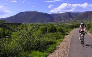
This 42-mile multi-use path spans from Herron Park in Aspen northwest to Two Rivers Park in Glenwoods Springs. A favorite section in Aspen is 8.4 miles from Woody Creek to Herron Park, which has views of Aspen Mountain and the Roaring Fork River.
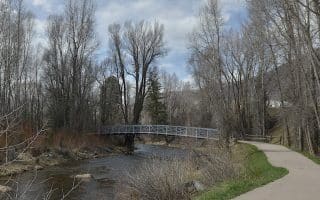
7-mile out and back on a popular multi-use trail along the Roaring Fork River. Highlights include wildlife viewing at the North Star Nature Preserve. One of the flatter running opportunities in Aspen. Combination paved and gravel.
Nearly 6 miles of uninterrupted pavement running through scenic farmland, Snowmass Village to Aspen Mountain/Buttermilk. One of the better non trail running options in the area.
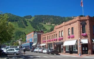
The historic village of Aspen makes for a scenic and interesting run. We suggest creating your own route, incorporating galleries and shops along roads lined with Victorian era buildings, and pretty residential side streets.
A 5 mile out and back on a concrete path, starting at the Airport/Aspen Business Center. Loop with other multi use paths for more mileage.
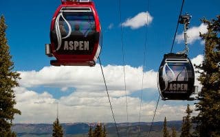
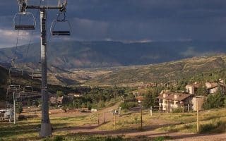
Steep Aspen Mountain offers wonderful trail running opportunities. On the lower mountain, the 2-mile out and back Ajax Trail is a good intermediate option. Or, take the gondola to the summit and run the 2.4 mile East Rim/Cherry Hill Loop.
Snowmass Mountain offers a good variety of trail running options, from 'family friendly' to steep and challenging. The trails are divided into the Bike Park and Elk Camp sections. Some trails are lift service access. Good map w/trail descriptions.
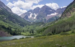
A long, steady climb with great views of the Maroon Bells. It's 9.3 miles between the roundabout in Aspen and Maroon Lake. Shuttle buses allow for shorter options. Road closed to cars during the day in summer!
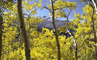
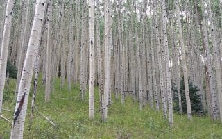
A more challenging trail run, spanning across Red Mountain. As much as 10 miles out and back, although a good 6-mile out and back option is possible. Highlight is the section through aspen groves -- especially pretty in autumn!
The tough and hilly 7-mile Hunter Creek Trail is a popular running route for its proximity to town and fantastic views of the Elk Mountain Range. The first 3 miles are especially popular for jogging -- but still challenging!
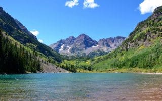
This rocky 1.8 mile trail winds through aspen fields and rock gardens before descending to Crater Lake and a beautiful vista of the Maroon Bells. Beautiful, but runners should note the rocky footing.
User Ratings
Leave A Review or Comment
Review or Comment on This Route/Share a Photo!
Share your feedback on this route and see that of other Great Runs users. Click on the image icon to upload a photo. And please let us know if there are notes or changes we should incorporate!