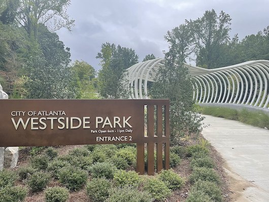
Westside Park, Atlanta’s newest park and largest greenspace, is a great addition to the city’s running scene. There are five miles of paved trails, anchored by the 2.5-mile Proctor Creek Greenway — a paved multi-use path that runs from the Bankhead metro station to West Highlands. The park’s terrain includes wooded walking paths, grassy meadows, and dramatic rocky cliffs. There’s ample parking and good restroom facilities.
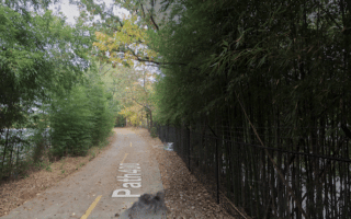
For running in the park, there are three paved loop trails that can be combined: purple loop (1.35 miles); blue loop (0.5 miles); yellow loop (0.3 miles, some good stairs); red trail (0.66 miles). Combine with the Proctor Creek Trail for a good 6-7 mile run!
Add-Ons: NEW [2025]: Connect to the Atlanta Beltline Westside Trail, which is 0.5 miles east. Use the Connector Trail along GA 78. Also, the Grove Park neighborhood at the park’s southern end has quiet residential streets that are fine for running.
Westside Park, Atlanta’s newest park and largest greenspace, is a great addition to the city’s running scene. There are five miles of paved trails, anchored by the 2.5-mile Proctor Creek Greenway — a paved multi-use path that runs from the Bankhead metro station to West Highlands. The park’s terrain includes wooded walking paths, grassy meadows, and dramatic rocky cliffs. There’s ample parking and good restroom facilities.
For running in the park, there are three paved loop trails that can be combined: purple loop (1.35 miles); blue loop (0.5 miles); yellow loop (0.3 miles, some good stairs); red trail (0.66 miles). Combine with the Proctor Creek Trail for a good 6-7 mile run!
Add-Ons: NEW [2025]: Connect to the Atlanta Beltline Westside Trail, which is 0.5 miles east. Use the Connector Trail along GA 78. Also, the Grove Park neighborhood at the park’s southern end has quiet residential streets that are fine for running.


Review or Comment on This Route/Share a Photo!
Share your feedback on this route and see that of other Great Runs users. Click on the image icon to upload a photo. And please let us know if there are notes or changes we should incorporate!