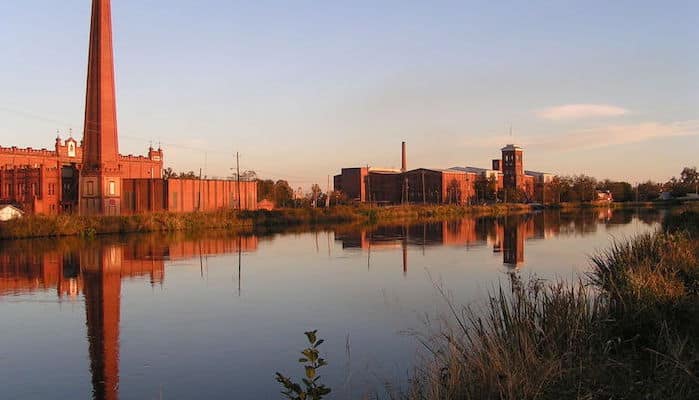
The Augusta Canal is a National Heritage Area, showcasing the canal built in 1845 to harness the power of the Savannah River. It’s now an extensive recreation area and Augusta’s signature running spot, consisting of a network of four main trails stretching along the Savannah River and the Augusta Canal. This Trail Map is a great overview.
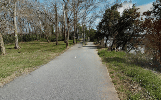
Main Towpath (yellow on the trail map). The main towpath is a 7 mile (one-way) gravel route between the Columbia County Visitors Center in the north and University Hospital in the south. (The stretch of this trail on the west bank is sometimes known as the Mill Village Trail). CANAL TRAIL ROUTE MAP.
River Levee Trail (purple on the trail map). Runs for 4 miles between Aqueduct Park and Olde Town, mainly along the Savannah River. Starting from Aqueduct Park, the trail runs for 2 miles along 104 and the Savannah River until 13th Street, where it becomes the New Bartram Trail/Augusta Riverwalk through Oglethorpe Park. Runners can follow another 2 miles until the concrete/brick path turns to dirt at Reynolds Street. RIVER LEVEE TRAIL ROUTE MAP.
The Third Level Trail is a slightly less scenic but practical .8 mile concrete trail between 12th Street and 7th Street. THIRD LEVEL TRAIL ROUTE MAP.
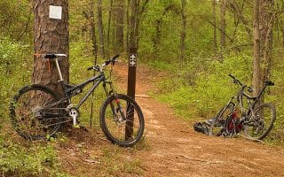
Runners will also find side paths along the way like the Old Fish Camp Path, River Shoals Nature Trail, Mountain Bike Singletrack, and the Lake Olmstead Trail.
The Augusta Canal is a National Heritage Area, showcasing the canal built in 1845 to harness the power of the Savannah River. It’s now an extensive recreation area and Augusta’s signature running spot, consisting of a network of four main trails stretching along the Savannah River and the Augusta Canal. This Trail Map is a great overview.
Main Towpath (yellow on the trail map). The main towpath is a 7 mile (one-way) gravel route between the Columbia County Visitors Center in the north and University Hospital in the south. (The stretch of this trail on the west bank is sometimes known as the Mill Village Trail). CANAL TRAIL ROUTE MAP.
River Levee Trail (purple on the trail map). Runs for 4 miles between Aqueduct Park and Olde Town, mainly along the Savannah River. Starting from Aqueduct Park, the trail runs for 2 miles along 104 and the Savannah River until 13th Street, where it becomes the New Bartram Trail/Augusta Riverwalk through Oglethorpe Park. Runners can follow another 2 miles until the concrete/brick path turns to dirt at Reynolds Street. RIVER LEVEE TRAIL ROUTE MAP.
The Third Level Trail is a slightly less scenic but practical .8 mile concrete trail between 12th Street and 7th Street. THIRD LEVEL TRAIL ROUTE MAP.
Runners will also find side paths along the way like the Old Fish Camp Path, River Shoals Nature Trail, Mountain Bike Singletrack, and the Lake Olmstead Trail.


Review or Comment on This Route/Share a Photo!
Share your feedback on this route and see that of other Great Runs users. Click on the image icon to upload a photo. And please let us know if there are notes or changes we should incorporate!