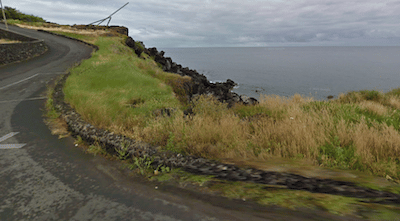
Between Fort of Greta and Porto Judeu. Nice running on the quiet M509 road for 4 km at the southeastern end of the island. From the Fort of Greta (old Fort), you’ll pass the Forte das Cavalas ruin, grottos, and several ‘natural pool’ sites where you can take a nice post-run dip! There are a couple of sections of dedicated path. Note: no shoulder or sidewalk, but a fairly quiet road. ROUTE MAP
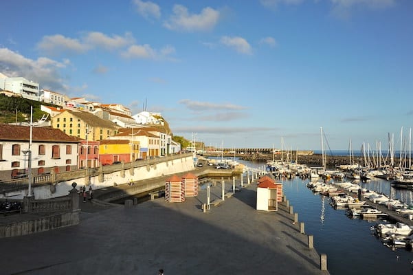
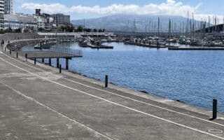
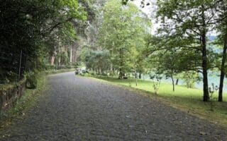
Area Around Angra do Heroísmo. Up to 6 km of nice waterfront running in the area the historical capital of the Azores and UNESCO World Heritage Site. From just east of the city at Forte de São Sebastião, a road with a decent sidewalk winds around the marina, featuring nice waterfront views. Take a jaunt down the pier, then continue past the beach and along Estrada Gaspar Corte-Real, then on the paths of the municipal park. Then join the main EN1-1A road, continuing west for another 2 km to Villa Maria Bay. This section of the road has a sidewalk and some views to the water. Also, a running track just 1.5 km inland, at Estádio João Paulo II. ROUTE MAP
- Add-On: Get the heart rate in the Monte Brasil preserve, which comes off the above route. There are paths and roads that lead to several gorgeous viewpoints. Good footing but steep climbing! ROUTE MAP
Silveira to Negrito. Just west of Angra, there’s scenic waterfront running for ~4 km in the Silveira to Negrito area. Part of this is on the main EN1-1A road — which has a cobblestone sidewalk in this section — and part is on side roads that dip down toward the water. The sidewalk starts just east of the Forte do Negrito, and runs west for 4 km to Canada do Casado road. ROUTE MAP
Biscoitos Area. On the northern end of the island, there’s a short but gorgeous road that runs above the water featuring spectacular views. And a wide sidewalk! Park at the Biscoitos Natural Swimming Area parking lot, and run the Camino Vinhas do Mar road, which goes for 2.3 km between the Forte da Rua Longa and the end of the road just west of Forte de São Pedro. Bonus: take a dip in the ‘natural pool’! ROUTE MAP

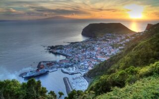
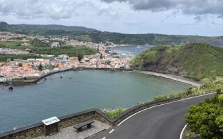
Praia da Vitória Area. At the eastern end of the island, Praia da Vitória is a popular beach and where ferries come into Terceira. There’s some pleasant waterfront running here, on a road off the EN1 between Praia da Riviera and the Miradouro da Ponta da Má Merenda. This includes a 1 km waterfront promenade along the Praia da Vitória (beach). ROUTE MAP


Review or Comment on This Route/Share a Photo!
Share your feedback on this route and see that of other Great Runs users. Click on the image icon to upload a photo. And please let us know if there are notes or changes we should incorporate!