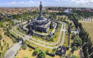
Serangan Island is not one of the more heavily visited spots in Bali, but it offers some of the best running opportunities. Only a 15 minute drive from Denpasar, Kuta, and Sanur, it’s a worth-it destination for some longer, waterside runs on quiet gravel roads. There are numerous running opportunities on Serangan, several overlapping. Acknowledgments to Bali Buddies for their route description.
Western Serangan Loop. This is an 8k (5 mile) loop with the most waterfront opportunities, along the sea and a lake. From just over the bridge, follow the unnamed road on the western side of the island south for 3 km. Great water views. Then, keep following that same (and only) road east for 1 km east, then curling back north, passing the Pura Puncak Kingki temple at the 6.5 km mark. Just remember to take a left at 7.7k to get back to the start (if reach lagoon have gone too far).
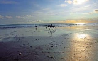
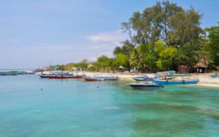
Eastern Serangan Loop. This is a just over 10k loop of the eastern part of the island, focused on the Serangan beaches. In case you want to do a longer, combo run with the western route (which would be 17 km), we start at the Pura Puncak Kingki temple. Head north along the path for 1 km, and then turn RIGHT, following a jungle-like path. At the small temple, turn RIGHT, following to Pura Beji Tirtha Harum (km 2). Here you’ll see the ocean again and you turn left, where you keep on following the path along the water. Pass the Serangan Beach at 3.6 km, a cute fishing vilage (Pantai Serangan II at km 4.4), and Secret Beach at km 5.3. Loop around the northeastern section of the island, following the Jl. Pantai Serangan 3 road, then curling around a lake at km 7-8. Follow the main road north and then east to the starting point. This can be shortened for a quicker and easier to follow eastern loop of 7.5 km., using Serangan Beach as an anchor. MAP
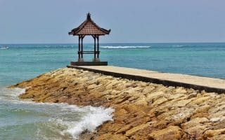
Northeastern/Marina Loop. A really pretty, quick 4.5k loop that can be done as a standalone. The bridge over to the island is runnable, with a decent shoulder/sidewalk and great water views. Then, continue along the main road, nice and flat along a lagoon/canal, to the ferry terminal (2k mark), passing the Turtle Conservation Center. Then curl around the northern section, running along the main road, Jl. Tukad Punggawa, with pretty views of the marina (Turtle Park at km 3).
Serangan Island is not one of the more heavily visited spots in Bali, but it offers some of the best running opportunities. Only a 15 minute drive from Denpasar, Kuta, and Sanur, it’s a worth-it destination for some longer, waterside runs on quiet gravel roads. There are numerous running opportunities on Serangan, several overlapping. Acknowledgments to Bali Buddies for their route description.
Western Serangan Loop. This is an 8k (5 mile) loop with the most waterfront opportunities, along the sea and a lake. From just over the bridge, follow the unnamed road on the western side of the island south for 3 km. Great water views. Then, keep following that same (and only) road east for 1 km east, then curling back north, passing the Pura Puncak Kingki temple at the 6.5 km mark. Just remember to take a left at 7.7k to get back to the start (if reach lagoon have gone too far).
Eastern Serangan Loop. This is a just over 10k loop of the eastern part of the island, focused on the Serangan beaches. In case you want to do a longer, combo run with the western route (which would be 17 km), we start at the Pura Puncak Kingki temple. Head north along the path for 1 km, and then turn RIGHT, following a jungle-like path. At the small temple, turn RIGHT, following to Pura Beji Tirtha Harum (km 2). Here you’ll see the ocean again and you turn left, where you keep on following the path along the water. Pass the Serangan Beach at 3.6 km, a cute fishing vilage (Pantai Serangan II at km 4.4), and Secret Beach at km 5.3. Loop around the northeastern section of the island, following the Jl. Pantai Serangan 3 road, then curling around a lake at km 7-8. Follow the main road north and then east to the starting point. This can be shortened for a quicker and easier to follow eastern loop of 7.5 km., using Serangan Beach as an anchor. MAP
Northeastern/Marina Loop. A really pretty, quick 4.5k loop that can be done as a standalone. The bridge over to the island is runnable, with a decent shoulder/sidewalk and great water views. Then, continue along the main road, nice and flat along a lagoon/canal, to the ferry terminal (2k mark), passing the Turtle Conservation Center. Then curl around the northern section, running along the main road, Jl. Tukad Punggawa, with pretty views of the marina (Turtle Park at km 3).


Review or Comment on This Route/Share a Photo!
Share your feedback on this route and see that of other Great Runs users. Click on the image icon to upload a photo. And please let us know if there are notes or changes we should incorporate!