There are numerous trail running options in & around Orono, with something for all abilities.
DeMeritt University Forest trail system. Part of the University of Maine trail system. The 15 miles of trails are divided into two sections: the South Section, between Rt. 2 & Rt. 2A (Stillwater Ave.) consists mainly of cycle paths near the UMaine campus and several loop options around woods and fields. From the New Balance Athletic Center, there’s a 2.5 mile paved Recreational Trail (yellow in trail map). There’s also some singletrack at the northeast end. The North Section, north of Stillwater Ave., features mainly wooded trails through the University of Maine Forest. TRAIL MAP
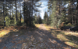
Caribou Bog Conservation Area. 18 miles of trails with a nice variety from easy to advanced. Good spot for some hill work on trails that include ~280-foot Bangor Hill and Newman Hill, and a nice loop around the bog. Kiosk with map. Parking areas off Taylor Rd. & Kirkland Rd. INFORMATION & MAPS
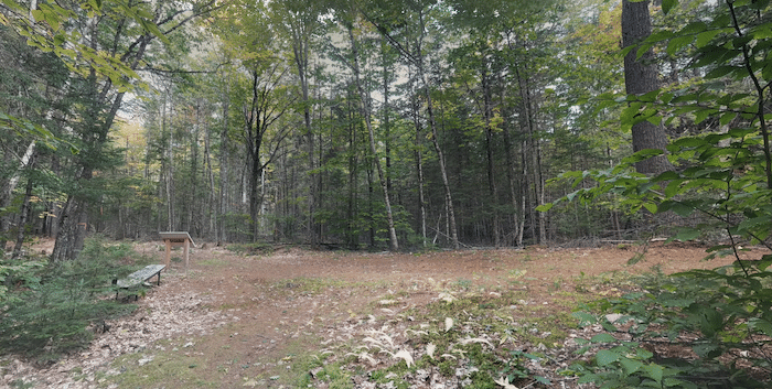
Rick Swan Trail System at Perch Pond. There are 15 miles of trails in this area located 7 miles northwest of Orono. These are more moderate to advanced trails. Mainly singletrack, with some mowed woods roads. Parking lots off Kirkland Rd. or Poplar St. Can combine with Hirundo National Wildlife Refuge, which is just north. INFORMATION & MAP
Hirundo Wildlife Refuge. 7 miles of easy-to-moderate trails, considered more of a hiking area. Quite scenic, with a combination of woods and some open sections. Combine with the Rick Swan Trail system (above). TRAIL MAP TRAIL INFORMATION
There are numerous trail running options in & around Orono, with something for all abilities.
DeMeritt University Forest trail system. Part of the University of Maine trail system. The 15 miles of trails are divided into two sections: the South Section, between Rt. 2 & Rt. 2A (Stillwater Ave.) consists mainly of cycle paths near the UMaine campus and several loop options around woods and fields. From the New Balance Athletic Center, there’s a 2.5 mile paved Recreational Trail (yellow in trail map). There’s also some singletrack at the northeast end. The North Section, north of Stillwater Ave., features mainly wooded trails through the University of Maine Forest. TRAIL MAP
Caribou Bog Conservation Area. 18 miles of trails with a nice variety from easy to advanced. Good spot for some hill work on trails that include ~280-foot Bangor Hill and Newman Hill, and a nice loop around the bog. Kiosk with map. Parking areas off Taylor Rd. & Kirkland Rd. INFORMATION & MAPS
Rick Swan Trail System at Perch Pond. There are 15 miles of trails in this area located 7 miles northwest of Orono. These are more moderate to advanced trails. Mainly singletrack, with some mowed woods roads. Parking lots off Kirkland Rd. or Poplar St. Can combine with Hirundo National Wildlife Refuge, which is just north. INFORMATION & MAP
Hirundo Wildlife Refuge. 7 miles of easy-to-moderate trails, considered more of a hiking area. Quite scenic, with a combination of woods and some open sections. Combine with the Rick Swan Trail system (above). TRAIL MAP TRAIL INFORMATION

Review or Comment on This Route/Share a Photo!
Share your feedback on this route and see that of other Great Runs users. Click on the image icon to upload a photo. And please let us know if there are notes or changes we should incorporate!