Features:
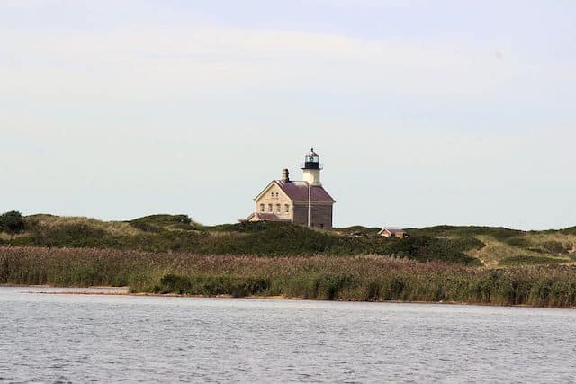
A coastal New England run just wouldn’t be a coastal New England run if it didn’t include lighthouses and roads with names like “Corn Neck.” Corn Neck Road, which runs all the way up the island’s Northern spit, has a nice stretch of paved shoulder and iconic Block Island views, including the Great Salt Pond, Sachem Pond, and Grove Point, before meeting up with a seaside trail that will carry you all the way to North Lighthouse, the island’s extreme north point. Take a break at the Sacred Labyrinth, a narrow circular walkway lined with stones meant for a peaceful walking meditation.
The full route is 9.4 miles out and back from downtown. The most scenic section is the 3 mile out and back section from the Block Island National Wildlife Refuge to the North Lighthouse. The views from Sandy Point seriously deliver. Note: Sections of Corn Neck Rd. don’t have much of a shoulder, but traffic is not too bad. Also, the trail to the lighthouse can be a bit soft in sections.
Add-On/Detour: Run out to Clay Head, or get lost in ‘The Maze’. Trail heads east off Corn Neck Rd., opposite the Wildlife Refuge.
Clay Head Route
- 9.4 miles roundtrip, but the nicest section can be done as an approximately 3 mile out and back from the Block Island National Wildlife Refuge to North Lighthouse.
- 0 feet
- Start anywhere on Corn Neck Road between downtown New Shoreham and North Lighthouse.
- Corn Neck Road can be accessed right off the ferry in Old Harbor. Or drive/take a cab to your chosen start point.


Comment on this Route/Share a Photo!
Share your feedback on this route and see that of other Great Runs users. Click on the image icon to upload a photo. And please let us know if there are notes or changes we should incorporate!