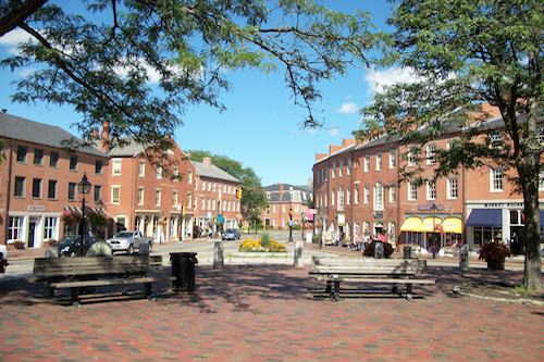
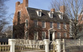
Newburyport is a lovely, historic coastal town 35 miles north of Boston. It features a quaint and festive town center, with well-preserved and restored buildings, waterfront parks, a great beach at Plum Island, bike paths, and the beautifully landscaped Maudslay state park. We have four great running options:
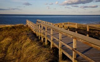
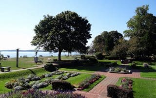
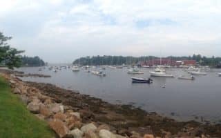
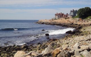
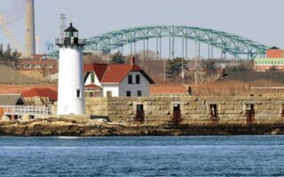
Waterfront Out to Plum Island. 4.5 miles (7.2 km) one-way. Starting at Cashman Park, run along waterside paths and Water St., for 2.5 miles, with nice views to the Merrimack River. Then, Plum Island Turnpike is a 2 mile, open road with great marsh and water views, and a good shoulder for running. Once on Plum Island, you can run paralleling the beach on Northern and Southern Blvd. for 2 miles — not a lot of water views but a great summer beach house colony and Plum Island Lighthouse. MAP
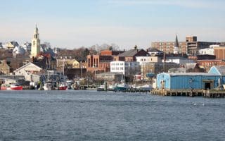
Clipper City Rail Trail. 3 miles (4.8 km) one-way. A pleasant, paved path that runs from Newburyport Commuter Rail station to the water for 1.2 miles, where you can continue along waterfront paths. Industrial at first, then pleasant through downtown. Can also run over the Bridge, and continue along the trail for another mile. Nice marsh views on the northern side. MAP (to water). MAP (over bridge & north side).
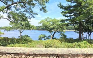
Maudslay State Park. This 480-acre park features 19th century gardens and plantings, rolling meadows, towering pines, and one of the largest naturally-occurring stands of mountain laurel in Massachusetts. One can easily put together a 4-5 mile run here. See this MAP of the trails and guide to suggested walks/rides. A local favorite is the 5 km trail named after Travis Landreth, a local elite runner who sadly passed away at the age of 24.
Newburyport is a lovely, historic coastal town 35 miles north of Boston. It features a quaint and festive town center, with well-preserved and restored buildings, waterfront parks, a great beach at Plum Island, bike paths, and the beautifully landscaped Maudslay state park. We have four great running options:
Waterfront Out to Plum Island. 4.5 miles (7.2 km) one-way. Starting at Cashman Park, run along waterside paths and Water St., for 2.5 miles, with nice views to the Merrimack River. Then, Plum Island Turnpike is a 2 mile, open road with great marsh and water views, and a good shoulder for running. Once on Plum Island, you can run paralleling the beach on Northern and Southern Blvd. for 2 miles — not a lot of water views but a great summer beach house colony and Plum Island Lighthouse. MAP
Clipper City Rail Trail. 3 miles (4.8 km) one-way. A pleasant, paved path that runs from Newburyport Commuter Rail station to the water for 1.2 miles, where you can continue along waterfront paths. Industrial at first, then pleasant through downtown. Can also run over the Bridge, and continue along the trail for another mile. Nice marsh views on the northern side. MAP (to water). MAP (over bridge & north side).
Maudslay State Park. This 480-acre park features 19th century gardens and plantings, rolling meadows, towering pines, and one of the largest naturally-occurring stands of mountain laurel in Massachusetts. One can easily put together a 4-5 mile run here. See this MAP of the trails and guide to suggested walks/rides. A local favorite is the 5 km trail named after Travis Landreth, a local elite runner who sadly passed away at the age of 24.
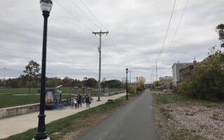
This newly completed paved rail-trail passes for 10 miles through Everett, Malden, and Saugus, ending in Lynn. Mix of landscape: industrial, woods, and some marsh views. Plans to extend 1.5 miles to the sea at northern end.
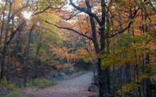
The second largest municipal park in the United States is a hidden gem just north of Boston. Trail running for all abilities: 10 miles of wide fire roads and 20 miles of more rugged trails. Three reservoirs, Dungeon Rock, rose gardens.
There are several great running beaches on Boston's North Shore. Closest to Boston is Revere Beach, and just north, Kings Beach and Nahant Beach. The most scenic is Crane's Beach in Ipswich. Salisbury Beach near the NH border is also good for running.
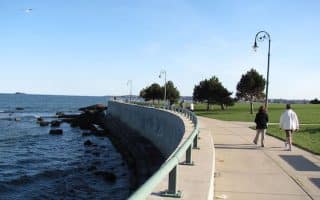
We love this run for its combination of boardwalk and runnable beach, with great water and Boston skyline views. There is a wide paved sidewalk/boardwalk paralleling Nahant Rd. and Lynn Shore Drive for nearly 3 miles.
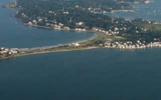
A fun running tour of the island of Nahant. Quiet roads for running with water views, some pretty homes, parks, and hills. Our full loop is 7 miles, but can be shortened, or lengthened with water views for 3 more miles to Swampscott!
One of the prettiest and most historic towns on Boston's North Shore. Wonderful running options include a loop of Marblehead Neck, waterfront roads hugging the harbor, historic streets, and off-road options on conservation land and a 4-mile rail trail.
A 'runseeing' tour of this historic coastal town, famous as a seaport and for the 1692 Witch Trials. Our 5-mile route is a modified version of the red-lined Heritage Trail, passing Salem's major sites, historic downtown, and the waterfront.
Beverly is another pleasant town on Boston's north shore, just north of Salem. We've put together a 4-mile loop, combining some lovely waterfront running, several parks, and Beverly's historic downtown.
Scenic Olmsted-designed former estate and farm on Lake Wenham in Beverly, restored and opened to the public in 2024. Enjoy 4 miles of trails on three 'carriage' loops around fields, forests, and estate grounds.
This affluent coastal town is known for the white-sanded Singing Beach. The best running is to create your own route along Beach St. and the roads off of it, leading past gorgeous homes and out to scenic vista points. Also nice running in Coolidge Reservation.
Some of the most scenic waterfront running on the North Shore centers around the small town of Magnolia, which lies between Manchester-By-The-Sea and Gloucester. Enjoy great coastal views, quiet roads, gorgeous homes.
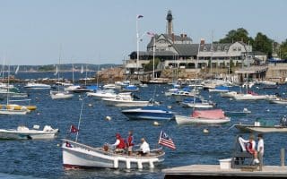
Important center of the fishing industry and a popular summer destination. The best running is a ~2 mile stretch along the Harbor, and on Eastern Point, where the Atlantic Ave. side boasts fantastic views and homes. The hilly village is also fun to explore.
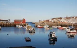
The town is known for its fishing harbor, granite quarries, boulder-strewn beaches, and the famous "Motif #1". We've mapped a 3.3 mile one-way run near the center, with waterfront homes, great views, beach, and Bearskin Neck.
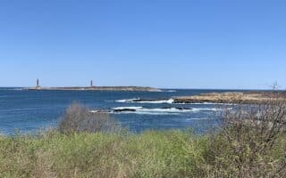
Pick a section of this 10-mile, 'hidden gem' one-way run between Gloucester and Rockport. Oceanfront promenades, two beach run sections, cute coves, gorgeous homes, and spectacular views. Seasonally a bus runs between the towns.
A separate guide for this area, with wonderful running in the coastal area from Salisbury Beach to the border just south of Kittery, Maine. Plus some interior off-road trails that are great for running.
Share your feedback on this route and see that of other Great Runs users. Click on the image icon to upload a photo. And please let us know if there are notes or changes we should incorporate!
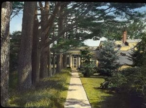 Maudslay State Park. This 480-acre park features 19th century gardens and plantings, rolling meadows, towering pines, and one of the largest naturally-occurring stands of mountain laurel in Massachusetts. One can easily put together a 4-5 mile run here. See this MAP of the trails and guide to suggested walks/rides. A local favorite is the 5 km trail named after Travis Landreth, a local elite runner who sadly passed away at the age of 24.

Review or Comment on This Route/Share a Photo!
Share your feedback on this route and see that of other Great Runs users. Click on the image icon to upload a photo. And please let us know if there are notes or changes we should incorporate!