Features:
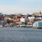
For a longer run and some of the prettiest waterfront running in New England, we’ve mapped 10-mile, ‘hidden gem’ one-way route between Gloucester and Rockport. The route includes oceanfront promenades, two beach run sections, cute coves, gorgeous homes, and spectacular views. Seasonally, a bus runs between Gloucester and Rockport (info), enabling a one-way run (or drop off a bike/car or arrange with a partner!). Do the whole route our use this guide to experience a part of it!
Start in Gloucester at Atlantic Ave. & Farrington. The first 1.4 miles is a lovely section along the sidewalk of Atlantic Ave., with ocean views on the right and spectacular homes on the left. Reach Good Harbor Beach, a wide. 1/2 mile long beach that often has excellent, firm sand for running. Exit Good Harbor Beach onto Salt Island Rd., then LEFT on Palfrey, RIGHT on Rockport Rd., reaching Long Beach – a similarly runnable, 0.75 mile beach. At the end of the beach, exit onto a road and take a wooden boardwalk that has public access to Rt. 127A. This next 0.7 mile section is along 127A, which is narrow in spots — use caution! At the 4.5 mile mark, RIGHT on Tregony Bow, then LEFT on Penzance Rd., enjoying the next 1.8 waterfront miles along quiet Penzance & Eden Rd. Return to 127A, continuing north for 0.3 miles. For the next cove, RIGHT on Marmion Way, and stay along the waterside roads and paths (Old Garden Rd., Atlantic Ave.). The final 1 mile is in the center of Rockport, with a jaunt out to Bearskin Neck and along Beach St.
- 10 miles (16 km) one-way
- 317 feet (one-way, headed north)
- South end of route is at Atlantic Ave. & Farrington, though you an join at any point; Northern end is Rockport Center
- Numerous access points.


Comment on this Route/Share a Photo!
Share your feedback on this route and see that of other Great Runs users. Click on the image icon to upload a photo. And please let us know if there are notes or changes we should incorporate!