This is a lovely run in the northern section of Charleston, combining the campus of The Citadel, Hampton Park, and the surrounding neighborhood. Use our map an outline to create/modify your route.
Citadel campus. Author Photo
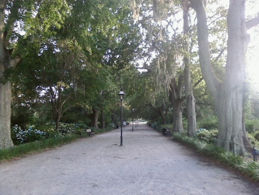
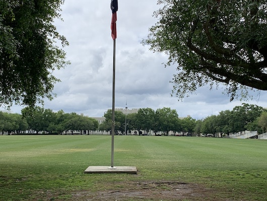
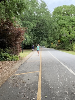
Start at the entrance gazebo of Hampton Park, a park anchoring the historic, planned Hampton Park Terrace neighborhood. It’s exactly 1 mile around the multi-use path around the perimeter (great for laps!). Enjoy some of the interior park paths, which range from beautifully landscaped to some shaded, woodsy sections. At the west end of the park, do a loop around the campus of The Citadel, a historic military college with impressive buildings and fields. Conclude your route by enjoying some of the pleasant side streets of the historic neighborhood, which feature lovely homes.
Hampton Park 1-miler! Author Photo
Add-Ons: Enjoy some of the additional residential streets. For a longer run, Hampton Park can be accessed from downtown Charleston (it’s 3 miles from the Battery at the extreme south end), or ~3 miles along the water from The Battery to Brittlebank Park.
This is a lovely run in the northern section of Charleston, combining the campus of The Citadel, Hampton Park, and the surrounding neighborhood. Use our map an outline to create/modify your route.
Citadel campus. Author Photo
Start at the entrance gazebo of Hampton Park, a park anchoring the historic, planned Hampton Park Terrace neighborhood. It’s exactly 1 mile around the multi-use path around the perimeter (great for laps!). Enjoy some of the interior park paths, which range from beautifully landscaped to some shaded, woodsy sections. At the west end of the park, do a loop around the campus of The Citadel, a historic military college with impressive buildings and fields. Conclude your route by enjoying some of the pleasant side streets of the historic neighborhood, which feature lovely homes.
Hampton Park 1-miler! Author Photo
Add-Ons: Enjoy some of the additional residential streets. For a longer run, Hampton Park can be accessed from downtown Charleston (it’s 3 miles from the Battery at the extreme south end), or ~3 miles along the water from The Battery to Brittlebank Park.
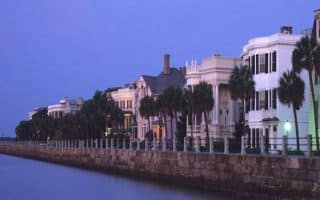
Lots of ways to explore Charleston's spectacular historic district. Get up early and create your own route before the crowds hit. We've mapped an outline route and also a lovely 2.6-miler 'straight shot' on pretty streets to Colonial Lake. Many options to vary.
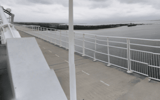
A must-do running experience on Charleston is the run from downtown over the Arthur Ravenel Bridge. It looks daunting, but there's a wide, well-protected multi-use path that's popular with pedestrians and cyclists. Additional options to explore Patriots Point.
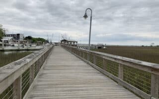
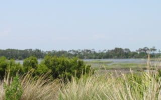
One of the hidden gems for running in Charleston. There are waterfront boardwalks, gorgeous homes, and a pedestrian ocean walk at the end of Pitt St. Some nice additional running options in the northeastern part of Mount Pleasant, as well.
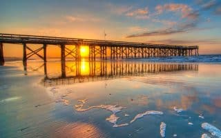
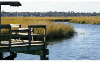
A worth-it destination run, located east of Charleston. Enjoy 2.5 miles from the mainland to Sullivan's island with wetland and water views. On the island, there are nice waterfront roads, attractive homes, and great beach running.
This popular beach and golf resort is a barrier island 24 miles southwest of Charleston. It's a treat for running, with 10 miles of beach with packed sand, and 30 miles of bike trails. Private island but public can enter by foot.
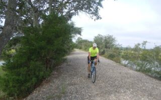
Just across the Ashley River from Charleston, runners can explore the West Ashley Greenway. The multi-use trail roughly parallels US 17 through a combination of residential neighborhoods, schools, parks, and a marsh. 8.2 miles one-way.
10+ miles of paved multi-use paths along the residential streets of the Crowfield Plantation housing development in the Goose Creek suburb north of Charleston, plus 15 miles of trails in Wannamaker North County Park.
Share your feedback on this route and see that of other Great Runs users. Click on the image icon to upload a photo. And please let us know if there are notes or changes we should incorporate!


Review or Comment on This Route/Share a Photo!
Share your feedback on this route and see that of other Great Runs users. Click on the image icon to upload a photo. And please let us know if there are notes or changes we should incorporate!