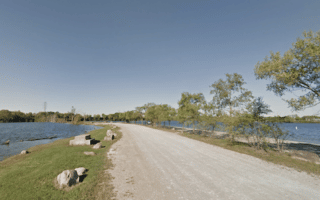
The Great Miami River Trail runs is one of the longest continuous paved trails in the United States, running for some 93 miles along the Miami River. We’ve mapped 60 miles of the trail from Dayton in two sections: 38 miles north to Piqua, and 21 miles south to Franklin. This interactive map is also a good resource. Right in downtown, the first 1-2 miles north or south get involved a bit with the highway tangle of I-75/Highway 35. Generally, the trail is more scenic headed south.
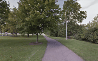
South toward Franklin. From downtown, the trail is along the east bank of the Miami River. It’s a pleasant and scenic 3.5 miles to Carillon Historical Park/Wright Brothers Museum, and 6.7 miles to the East River Landing. Water views most of the way.
There’ also a 2-mile section on the west bank, south to the University of Dayton Softball Stadium (running track at Welcome Stadium!).
North toward Troy & Piqua. Pick up the trail off W Third St. A couple of nice sections:
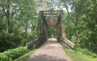
- 2.5 miles north to Island MetroPark (additional trails) and 4.6 miles to where the trail leaves the river. Nice water views and lots of
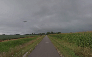
- Head north on the Miami River Trail for 3 miles to Triangle Park and then pick up the Stillwater River Trail for another 2 miles north to Wegerzyn Garden. A good 10-mile out and back, with river views and numerous parks.
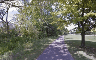
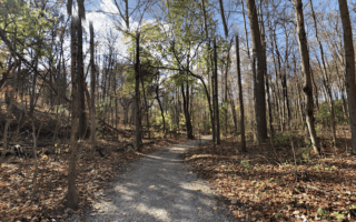
- Taylorsville MetroPark. At miles 12-14, nice park with wooded section of Miami River Trail and other trails. Just shy of the 15-mile park, you can connect to the Charleston Falls Preserve, which is 1 mile east using Ross Rd.
Add-Ons: Numerous other mutli-use trails connect: Mad RiverTrail downtown, Stillwater Trail, and additional trails in some of the parks.
The Great Miami River Trail runs is one of the longest continuous paved trails in the United States, running for some 93 miles along the Miami River. We’ve mapped 60 miles of the trail from Dayton in two sections: 38 miles north to Piqua, and 21 miles south to Franklin. This interactive map is also a good resource. Right in downtown, the first 1-2 miles north or south get involved a bit with the highway tangle of I-75/Highway 35. Generally, the trail is more scenic headed south.
South toward Franklin. From downtown, the trail is along the east bank of the Miami River. It’s a pleasant and scenic 3.5 miles to Carillon Historical Park/Wright Brothers Museum, and 6.7 miles to the East River Landing. Water views most of the way.
There’ also a 2-mile section on the west bank, south to the University of Dayton Softball Stadium (running track at Welcome Stadium!).
North toward Troy & Piqua. Pick up the trail off W Third St. A couple of nice sections:
- 2.5 miles north to Island MetroPark (additional trails) and 4.6 miles to where the trail leaves the river. Nice water views and lots of
- Head north on the Miami River Trail for 3 miles to Triangle Park and then pick up the Stillwater River Trail for another 2 miles north to Wegerzyn Garden. A good 10-mile out and back, with river views and numerous parks.
- Taylorsville MetroPark. At miles 12-14, nice park with wooded section of Miami River Trail and other trails. Just shy of the 15-mile park, you can connect to the Charleston Falls Preserve, which is 1 mile east using Ross Rd.
Add-Ons: Numerous other mutli-use trails connect: Mad RiverTrail downtown, Stillwater Trail, and additional trails in some of the parks.


Review or Comment on This Route/Share a Photo!
Share your feedback on this route and see that of other Great Runs users. Click on the image icon to upload a photo. And please let us know if there are notes or changes we should incorporate!