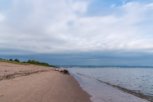
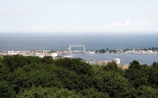
Also known as Minnesota Point, Park Point is a long, narrow sand spit that extends out from Canal Park, separating Lake Superior from Superior Bay and the Duluth Harbor Basin. The area makes for a nice run, on a combination of road and 2-mile long Nature Trail, that extends to a spectacular point of the Superior Entry Channel. Note: sections of the Nature Trail might be soft sand. Watch out for poison ivy in season!
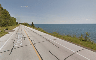
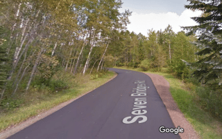
We start at Hartman Park, which is where the road opens up to nice water views. It’s 1.2 miles along the road to the Park Point Recreation Area and the beginning of the Nature Trail. This is the easiest section of the run. The Nature Trail goes for ~ 2 miles, passing the Zero Point Lighthouse (3.7 mile mark), to the end of the spit. The trail surface is a combination of dirt and sand. Some sections are a bit wooded, others are more open with some water views. The full out and back from Hartman Park is a 10k!
Note that Minnesota Rd., which extends from 3.5 miles from the Aerial Bridge to Hartman Park, is runnable — but it a bit of a long, boring road with no water views until you near the Recreation Area.
Also known as Minnesota Point, Park Point is a long, narrow sand spit that extends out from Canal Park, separating Lake Superior from Superior Bay and the Duluth Harbor Basin. The area makes for a nice run, on a combination of road and 2-mile long Nature Trail, that extends to a spectacular point of the Superior Entry Channel. Note: sections of the Nature Trail might be soft sand. Watch out for poison ivy in season!
We start at Hartman Park, which is where the road opens up to nice water views. It’s 1.2 miles along the road to the Park Point Recreation Area and the beginning of the Nature Trail. This is the easiest section of the run. The Nature Trail goes for ~ 2 miles, passing the Zero Point Lighthouse (3.7 mile mark), to the end of the spit. The trail surface is a combination of dirt and sand. Some sections are a bit wooded, others are more open with some water views. The full out and back from Hartman Park is a 10k!
Note that Minnesota Rd., which extends from 3.5 miles from the Aerial Bridge to Hartman Park, is runnable — but it a bit of a long, boring road with no water views until you near the Recreation Area.


Review or Comment on This Route/Share a Photo!
Share your feedback on this route and see that of other Great Runs users. Click on the image icon to upload a photo. And please let us know if there are notes or changes we should incorporate!