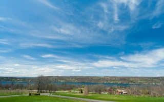
Seneca Lake is 38 miles long, anchored at the north end by Geneva and at the south end by Watkins Glen. Running Highlights at the South End are:
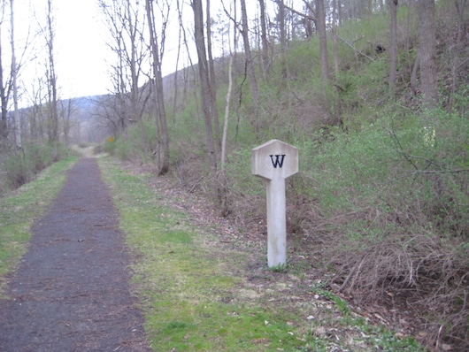
Catharine Valley Trail. 12 miles one-way, mainly uphill north-south (730 foot gain). The best off-road option in this area, the trail goes for 12 miles from Watkins Glen south to Pine Valley. It’s wide, with stone dust surface, and mainly wooded except for through the towns. Much of the trail parallels the Barge Canal and Rt. 14. Scenic highlights include historic towns, waterfalls, some parks, and some nice canal views. This Trail Map has excellent info on sites & segment distances. Route Map.
Odessa-Hector Rail Trail. This new gravel-surfaced rail-trail, opened in 2023, follows an old rail line for 2.5 miles between Hayes Rd. in Montour and Texas Hollow Rd. in Odessa. The Hayes Rd. end is 2 miles east of the 2-mile mark of the Catharine Valley Trail at Marina Park. ROUTE MAP
Lakeside Park/Queen Catharine Marsh Trails. Create your own run on some of the paths in Lakeside Park, near the water, and then jump onto the footpaths of the Queen Catharine Marsh. Rock Cabin Rd. is a dirt road, 3 miles one-way, that’s part of the marsh trails and is especially good for running. Information
Watkins Glen State Park. The most popular park in the Finger Lakes, famous for its Gorge Trail (800 steps!). This is more for hiking/trail running.
Keuka Lake Outlet Trail: At the midpoint of Seneca Lake, western side. A moderate trail run that goes up to 7 miles one-way between Keuka Lake (Penn Yan) and Seneca Lake (Dresden). Mainly wooded. Generally downhill from Penn Yan, or uphill from Dresden. Passes Seneca Mills Falls. Trail Info.
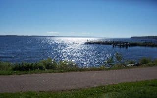
Sampson State Park. One of the best options for flat, off-road lakeshore running in the Finger Lakes. Comprising 2,000 acres, this park on the eastern shore of Seneca Lake has two trails: Lake Trail, is 3.5 miles one-way along the lake; and the 6.5 mile (return) History Trail, with marked sites along this former Naval Training base which was built in the 1940s. TRAIL MAP
Seneca Lake is 38 miles long, anchored at the north end by Geneva and at the south end by Watkins Glen. Running Highlights at the South End are:
Catharine Valley Trail. 12 miles one-way, mainly uphill north-south (730 foot gain). The best off-road option in this area, the trail goes for 12 miles from Watkins Glen south to Pine Valley. It’s wide, with stone dust surface, and mainly wooded except for through the towns. Much of the trail parallels the Barge Canal and Rt. 14. Scenic highlights include historic towns, waterfalls, some parks, and some nice canal views. This Trail Map has excellent info on sites & segment distances. Route Map.
Odessa-Hector Rail Trail. This new gravel-surfaced rail-trail, opened in 2023, follows an old rail line for 2.5 miles between Hayes Rd. in Montour and Texas Hollow Rd. in Odessa. The Hayes Rd. end is 2 miles east of the 2-mile mark of the Catharine Valley Trail at Marina Park. ROUTE MAP
Lakeside Park/Queen Catharine Marsh Trails. Create your own run on some of the paths in Lakeside Park, near the water, and then jump onto the footpaths of the Queen Catharine Marsh. Rock Cabin Rd. is a dirt road, 3 miles one-way, that’s part of the marsh trails and is especially good for running. Information
Watkins Glen State Park. The most popular park in the Finger Lakes, famous for its Gorge Trail (800 steps!). This is more for hiking/trail running.
Keuka Lake Outlet Trail: At the midpoint of Seneca Lake, western side. A moderate trail run that goes up to 7 miles one-way between Keuka Lake (Penn Yan) and Seneca Lake (Dresden). Mainly wooded. Generally downhill from Penn Yan, or uphill from Dresden. Passes Seneca Mills Falls. Trail Info.
Sampson State Park. One of the best options for flat, off-road lakeshore running in the Finger Lakes. Comprising 2,000 acres, this park on the eastern shore of Seneca Lake has two trails: Lake Trail, is 3.5 miles one-way along the lake; and the 6.5 mile (return) History Trail, with marked sites along this former Naval Training base which was built in the 1940s. TRAIL MAP

Review or Comment on This Route/Share a Photo!
Share your feedback on this route and see that of other Great Runs users. Click on the image icon to upload a photo. And please let us know if there are notes or changes we should incorporate!