Features:
Categories:
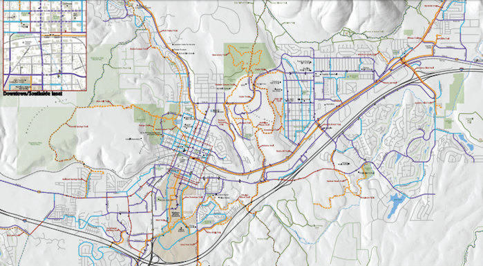
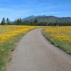
The Flagstaff Urban Trails System spans over 50 miles across the city, offering an array of running options through natural areas, residential neighborhoods, and bustling city streets. Surfaces vary from paved asphalt and concrete to hard-packed dirt. The trail system is accessible from almost anywhere in the city, and there are numerous routes for connections, loops, and additions. See the Flagstaff Urban Trails System overview map to find a trail near you, or find some of our suggested favorites below.
Sinclair Wash: At 5.6 miles (one way), Sinclair Wash is the longest trail in the FUTS network, and certainly one of the most scenic. Though small sections of the trail are concrete, it’s mostly a wide surface of hard packed dirt, and not much dramatic elevation change. At the northeast end, the trail begins at the intersection with the Arizona Trail near Route 40 and winds through a limestone canyon. From here, the trail bends west through Northern Arizona University, then the Woodlands Village shopping center, before heading south through open grasslands and ponderosas to Fort Tuthill County Park. To shorten the route (in either direction) some runners park at the Walmart in Woodlands Village. MAP.
Thorpe Park: Due to its close proximity to town, Thorpe Park is another popular starting place for running the FUTS network. From the park entrance at the base of Mars Hill, home of the Lowell Observatory, runners can enjoy the Thorpe Trail around the park as well as a couple of options: the 2 mile (one way) Mars Hill Trail is a smooth dirt path with a few tough climbs. The 3.1 mile (one way) hard-packed Karen Cooper Trail runs between Thorpe Park Center and the Museum of Northern Arizona.


Comment on this Route/Share a Photo!
Share your feedback on this route and see that of other Great Runs users. Click on the image icon to upload a photo. And please let us know if there are notes or changes we should incorporate!