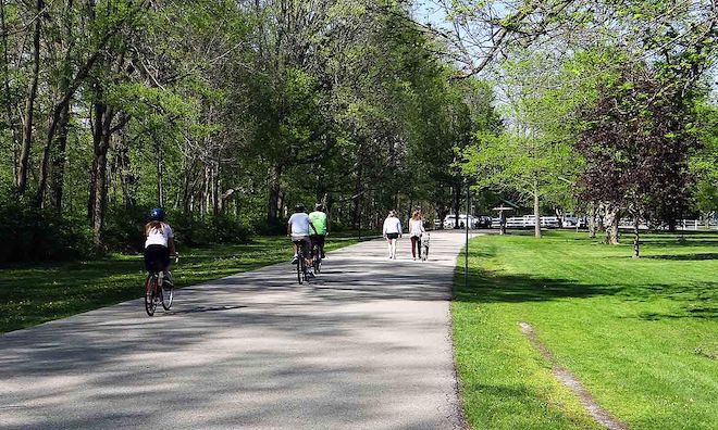
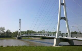
The Rivergreenway is the heart of running in Fort Wayne. This linear park path winds its way along the Maumee, St. Marys, & St. Joseph Rivers. Overall, there are 25+ miles of mainly paved, flat multi-use path, featuring numerous parks, recreation facilities, and lots of nice water views. This website has information about the greenway, trail maps, and distance maps. There are mile markers along all three river paths, starting from Three Rivers Water Filtration Park (there’s a pedestrian bridge crossing the St. Marys River from the Fort to Headwaters Park). . We’ve mapped the three main river paths from that park, which can be mixed & matched in numerous ways! We think the St. Marys River path is among the most scenic of the three. Thank you to John Klopsch for suggesting this route! Note: there can be occasional trail closures when river levels are high.
Good Bridges for Crossing: In the three rivers area there’s a railroad bridge that’s now a pedestrian crossing. Also, from downtown, Spy Run Ave., St. Joseph Blvd., Clinton St., Harrison St.
Maumee River Section: The Rivergreenway runs east along the Maumee River toward New Haven for up to 8.5 miles, mainly along the north bank. The path is pretty much along the river, with views a good part of the way, although blocked by trees in sections when there’s foliage. At the ~3 mile park is an area with several small lakes to the north. At mile 5 is a trailhead at Maplecrest Rd. At mile 6 is a nice add-on spur to Kraeger Park. The final 1 mile dips south away from the river to Moser Park in New Haven.
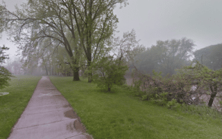
St. Marys River Section: The Rivergreenway runs along the St. Marys River, alternating between the east and west sides, for up to 8.8 miles from downtown south to Tilman Park. This is the most park-like of the three river paths. There are a few short on-road sections. Highlights include a nice downtown section for the first 2.5 miles through to Swinney Park, with nice river views, Foster Park (miles 5-6), and the southern 1.5 miles through Tilman Park. Note that south of mile 4 there aren’t a lot of water views.
St. Joseph River Section. The Rivergreenway runs along the west side of the St. Joseph River for 3.2 miles from downtown north to Johnny Appleseed Park. There are water views for much of the way, though occasionally blocked by trees. At the park, there’s the gravesite of Johnny Appleseed, the famous nurseryman & missionary. Add-Ons: Campus of Purdue University, just across Coliseum Blvd. Also a running track at Zollner Stadium.

Review or Comment on This Route/Share a Photo!
Share your feedback on this route and see that of other Great Runs users. Click on the image icon to upload a photo. And please let us know if there are notes or changes we should incorporate!