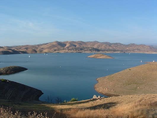
Millerton Lake State Recreation Area, located about 20 miles of Fresno, offers some excellent running options, with a mix of rolling hill roads and some hillier, more challenging trails. The recreation area was created after the 319-foot-tall Friant Dam was built across the river canyon in 1944 to form Millerton Lake, where the San Joaquin River flows out of the Sierra Nevada foothills and into the Central Valley. AREA BROCHURE
South Side of Millerton Lake. This is the best spot for an easier trail run that’s hilly but less so than the San Joaquin River Trail area. Our 10k Millerton Marina Loop starts the Historic Millerton Courthouse, using a combination of roads and wide trails, with views to Winchell Bay (6.2 mile loop, 408 foot gain). As a separate, flatter run or add-on, a separate, parallel path goes out to Mackenzie Point. From the Courthouse, it’s 5.5 miles out and back, or as an add-on to the Marina loop it’s 3 miles out and back. (5.5 miles, 267 foot gain).
San Joaquin River Trail. This hilly multi-use trail is a popular hike or trail run. Starting at the South Finegold Picnic Area, the trail runs for 3.1 miles underneath Pincushion Peak, fairly open terrain, with great views. It’s a 500 foot climb over the first 1.5 miles, then an equal decent down to the river. Footing is decent most of the way.
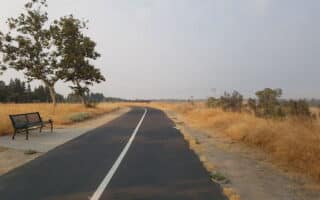
Sky Harbor Road. If you’d prefer a road run, Sky Harbor Road runs along the east side of Millerton Lake. It’s 6 miles from the South Finegold Picnic Area to Millerton Rd. If you want a flatter run, the first 2 miles from the Picnic Area is flatter, then it’s a steady, fairly steep climb of 500 feet over 1.5 miles, though the reward is great views. Note: the road has no shoulder.
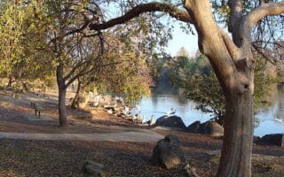
North Side of the Lake. On the north side of the lake, there’s scenic running on gently rolling hill roads and trails between the various campgrounds just above and on the lake. It’s 2 miles between Rocky Point Campground and Meadow Campground.
Millerton Lake State Recreation Area, located about 20 miles of Fresno, offers some excellent running options, with a mix of rolling hill roads and some hillier, more challenging trails. The recreation area was created after the 319-foot-tall Friant Dam was built across the river canyon in 1944 to form Millerton Lake, where the San Joaquin River flows out of the Sierra Nevada foothills and into the Central Valley. AREA BROCHURE
South Side of Millerton Lake. This is the best spot for an easier trail run that’s hilly but less so than the San Joaquin River Trail area. Our 10k Millerton Marina Loop starts the Historic Millerton Courthouse, using a combination of roads and wide trails, with views to Winchell Bay (6.2 mile loop, 408 foot gain). As a separate, flatter run or add-on, a separate, parallel path goes out to Mackenzie Point. From the Courthouse, it’s 5.5 miles out and back, or as an add-on to the Marina loop it’s 3 miles out and back. (5.5 miles, 267 foot gain).
San Joaquin River Trail. This hilly multi-use trail is a popular hike or trail run. Starting at the South Finegold Picnic Area, the trail runs for 3.1 miles underneath Pincushion Peak, fairly open terrain, with great views. It’s a 500 foot climb over the first 1.5 miles, then an equal decent down to the river. Footing is decent most of the way.
Sky Harbor Road. If you’d prefer a road run, Sky Harbor Road runs along the east side of Millerton Lake. It’s 6 miles from the South Finegold Picnic Area to Millerton Rd. If you want a flatter run, the first 2 miles from the Picnic Area is flatter, then it’s a steady, fairly steep climb of 500 feet over 1.5 miles, though the reward is great views. Note: the road has no shoulder.
North Side of the Lake. On the north side of the lake, there’s scenic running on gently rolling hill roads and trails between the various campgrounds just above and on the lake. It’s 2 miles between Rocky Point Campground and Meadow Campground.

Review or Comment on This Route/Share a Photo!
Share your feedback on this route and see that of other Great Runs users. Click on the image icon to upload a photo. And please let us know if there are notes or changes we should incorporate!