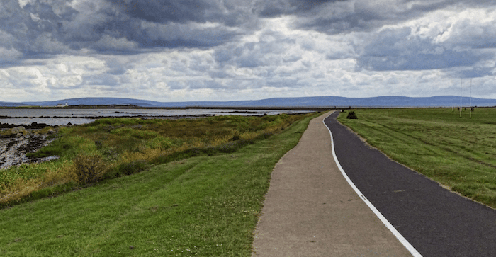
The highlight of running in Galway is the several miles of roads and promenades along the River Corrib and the North Atlantic, mainly headed south of the historic center. We’ve mapped a one-way route of 5+ miles to use as a guideline to choose your distance!
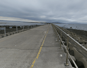
Mutton Island Causeway. Google Street View
Start at the Galway City Museum, running through the Spanish Arch and then do the loop around the marina/dock using The Long Walk path. Then head south along the water, using Claddagh Quay, with great views of the water and Galway’s iconic colored houses. Use Nimmo’s Pier to head into South Park, enjoying the park’s fields and waterside path. Then there’s the optional 2 km out and back to Mutton Island, using scenic Mutton Island Causeway. Great views! Continue south on the path alongside Grattan Rd. to the Famine Ship Memorial, and then on the Seapoint/Salthill Promenade south for another 3 km to its end in Salthill, passing Claude Toft Park, the Midway Point of The Wild Atlantic Way, Ladies Beach, and Salthill Public Park, skirting the southern edge of the Galway Golf Club golf course.
Add-Ons/Options: There are additional paths in parks adjoining the waterfront: South Park, Claude Toft Park, & Salthill Park. Can also combine with our ‘runseeing’ tour
The highlight of running in Galway is the several miles of roads and promenades along the River Corrib and the North Atlantic, mainly headed south of the historic center. We’ve mapped a one-way route of 5+ miles to use as a guideline to choose your distance!
Mutton Island Causeway. Google Street View
Start at the Galway City Museum, running through the Spanish Arch and then do the loop around the marina/dock using The Long Walk path. Then head south along the water, using Claddagh Quay, with great views of the water and Galway’s iconic colored houses. Use Nimmo’s Pier to head into South Park, enjoying the park’s fields and waterside path. Then there’s the optional 2 km out and back to Mutton Island, using scenic Mutton Island Causeway. Great views! Continue south on the path alongside Grattan Rd. to the Famine Ship Memorial, and then on the Seapoint/Salthill Promenade south for another 3 km to its end in Salthill, passing Claude Toft Park, the Midway Point of The Wild Atlantic Way, Ladies Beach, and Salthill Public Park, skirting the southern edge of the Galway Golf Club golf course.
Add-Ons/Options: There are additional paths in parks adjoining the waterfront: South Park, Claude Toft Park, & Salthill Park. Can also combine with our ‘runseeing’ tour
This 5-mile 'runseeing' tour hits many of Galway's historic highlights, adding some nice waterside paths along the River Corrib & Eglington Canal. Can be combined with our Galway Waterfront route for a longer run!
A pleasant 4.4 km loop around the Lough Atlalia (Lake), nearly all on dedicated walkways. Nice water views! Can be combined with our other central Galway routes for a longer run.
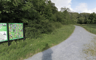
The largest woodland area near Galway. Some 4-5 km of pleasantly wooded paths around the former Waithman estate, and also the remains of Merlin Castle.
Share your feedback on this route and see that of other Great Runs users. Click on the image icon to upload a photo. And please let us know if there are notes or changes we should incorporate!


Review or Comment on This Route/Share a Photo!
Share your feedback on this route and see that of other Great Runs users. Click on the image icon to upload a photo. And please let us know if there are notes or changes we should incorporate!