Features:
Categories:
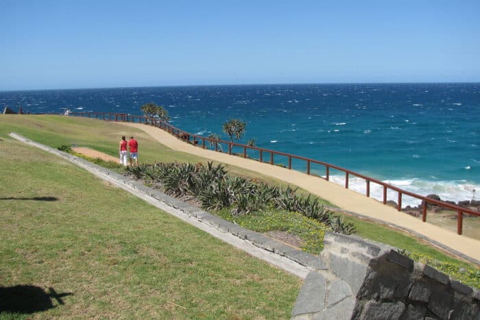
It’s not hard to find a great running route in Gold Coast — most runners just head for the water. The beaches of Gold Coast are all wide, flat, and great for running, but there are also some paved promenades along the waterfront — known collectively as the Gold Coast Oceanway. Most of these promenades can be strung together, but we’ve mapped out the continuous sections for reference, working from north to south.
The Spit to Main Beach:
The northernmost part of the Gold Coast Oceanway is best run south to north, starting from Hollindale Park. The path continues up past Mirage Marina and Seaworld, then meets Federation Walk Coastal Reserve. Federation Walk winds up the coast to “The Spit” a scenic jetty jutting into the bay. 5.6 km (3.5 miles) one-way. ROUTE MAP.
Main Beach/Surfers Paradise:
The Main Beach promenade begins at Narrowneck Park. One leg encircles Macintosh Island, while the rest of the path heads south along the coast to Surfers Paradise. The wide esplanade bypasses skyscrapers and busy beaches before it ends at Eileen Peters Park. 2.4 km (1.5 miles) one-way. ROUTE MAP.
Broadbeach to Mermaid Beach:
The next stretch of promenade begins at Broadbeach Boulevard and Australia Ave. It runs through Kurrawa Park and Pratten Park to Hedges Ave at Mermaid Beach. 1.6 km (1 mile) one way. ROUTE MAP.
Nobbys Beach to Burleigh Head:
Another piece of the Oceanway can be found between Thorn Park at Nobby Beach and Burleigh Head National Park. It runs through several parks until it meets the entrance of Burleigh Head National Park at 4 km (2.4 miles). Another 3.2 km of paths run through the national park — the Ocean View Track is especially scenic. ROUTE MAP.
Currumbin to Point Danger:
After skipping over the Tallebudgera Creek and Currumbin Creek, the Gold Coast Oceanway resumes along Currumbin Beach. It starts from the point and continues south along the Rainbow Bay to Point Danger. 9.5 km (5.9 miles) one-way. Nice viewpoints at Point Danger & Snapper Rocks. Goof beach running around here as well. ROUTE MAP.


Comment on this Route/Share a Photo!
Share your feedback on this route and see that of other Great Runs users. Click on the image icon to upload a photo. And please let us know if there are notes or changes we should incorporate!