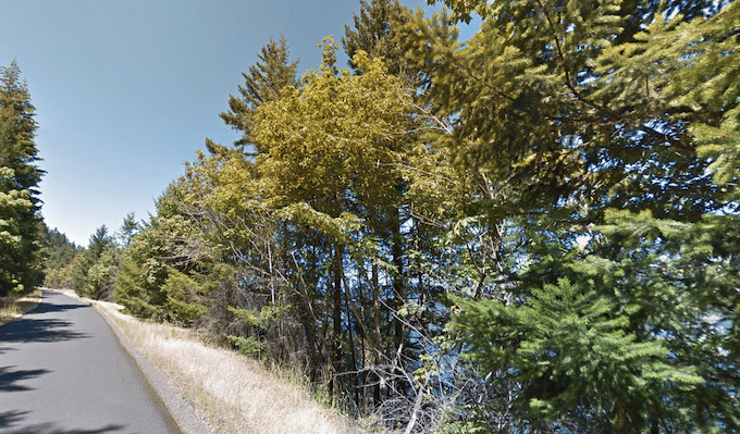
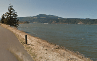
The former Columbia River Highway (Rt 30) is now a dedicated, paved multi-use path that runs alongside the Columbia River between Portland and Mosier. Overall, there are three sections of trail, totaling 12 miles, over three disconnected segments. This route is the Twin Tunnels Segment of the trail that runs between Hood River and Mosier. It’s a scenic, mainly wooded trail, with some views of the Columbia River and the surrounding hills. NOTE: Hilly
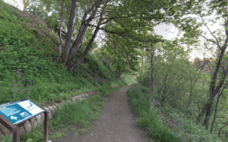
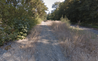
The Senator Mark O. Hatfield West Trailhead is 1.5 miles east of downtown Hood River. One could run along Old Columbia River Dr. to get to the trail, though there’s no sidewalk/shoulder. From the trailhead, head east for up to 4.5 miles to the Senator Mark O. Hatfield East Trailhead at Rock Creek Rd. in Mosier. It’s rolling hills, with a 200 foot climb between miles 2.2-2.7. Toward the eastern end, don’t miss running through the Mosier Twin Tunnels!
Add-Ons: See the trail information for the other sections this trail.
The former Columbia River Highway (Rt 30) is now a dedicated, paved multi-use path that runs alongside the Columbia River between Portland and Mosier. Overall, there are three sections of trail, totaling 12 miles, over three disconnected segments. This route is the Twin Tunnels Segment of the trail that runs between Hood River and Mosier. It’s a scenic, mainly wooded trail, with some views of the Columbia River and the surrounding hills. NOTE: Hilly
The Senator Mark O. Hatfield West Trailhead is 1.5 miles east of downtown Hood River. One could run along Old Columbia River Dr. to get to the trail, though there’s no sidewalk/shoulder. From the trailhead, head east for up to 4.5 miles to the Senator Mark O. Hatfield East Trailhead at Rock Creek Rd. in Mosier. It’s rolling hills, with a 200 foot climb between miles 2.2-2.7. Toward the eastern end, don’t miss running through the Mosier Twin Tunnels!
Add-Ons: See the trail information for the other sections this trail.


Review or Comment on This Route/Share a Photo!
Share your feedback on this route and see that of other Great Runs users. Click on the image icon to upload a photo. And please let us know if there are notes or changes we should incorporate!