Google Street View
Features:
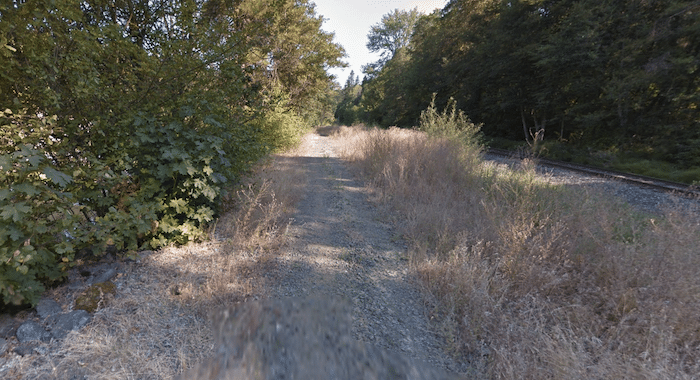
The Hood River Penstock Flume Pipeline Trail is a short trail that follows the outline of the Hood River and train tracks, headed south. The mainly wooded trail is 1.4 miles one-way. The surface/footing can be a bit rough in sections.
The northern trailhead is off Powerdale Rd. Head south for 1.4 miles to the south end.
Essentials
- 2.8 miles (4.5 km) out & back
- 193 feet (50m)
- Off Powerdale Ave.
- There's space for several cars to park off Powerdale Ave.

Comment on this Route/Share a Photo!
Share your feedback on this route and see that of other Great Runs users. Click on the image icon to upload a photo. And please let us know if there are notes or changes we should incorporate!