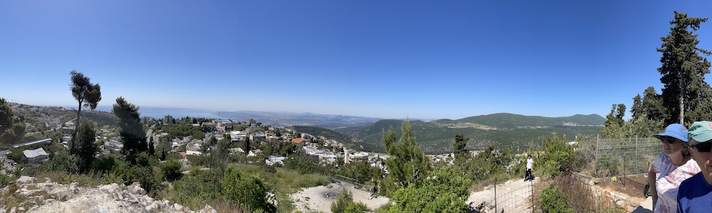
Safed, is city in the northern district of Israel. The Hebrew name is Tzfat. At 937m, it’s the highest city in the Galilee and in Israel. There’s some scenic, hilly running in Safed. Our thanks to Michael Fuchs for suggesting this run!
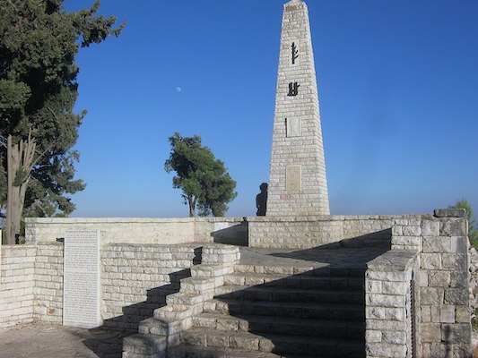
Jerusalem Rd. to Citadel. It’s possible to do a quite nice run to the Citadel. Also known as HaMetsuda Garden, this is a hilltop park with great views. We recommend running on Jerusalem St., then using the stairs or Derech Hativat at the Rothschild Garden to reach the Citadel. Jerusalem Rd. is narrow, but there’s a decent sidewalk. It’s good to go early. At the Citadel, there are some nice forested paths making for a~0.6 km loop. NOTE: Hilly!
View from Citadel. Photo: Michael FuchsLimonim Forest. Google Street View
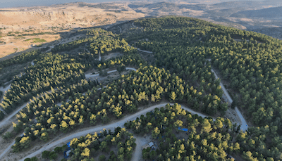
Limonim Forest. A few km south of Safed, Limonim Forest is a national park that is a good spot for some hiking or trail running. The hilly park has great views, and a network of fairly wide paths winding through Mediterranean Scrub & pine trees. This is moderate level trail running — hilly, and the trails are somewhat random. Access from the 89 Road, near the Ziv Medical Center.
Safed, is city in the northern district of Israel. The Hebrew name is Tzfat. At 937m, it’s the highest city in the Galilee and in Israel. There’s some scenic, hilly running in Safed. Our thanks to Michael Fuchs for suggesting this run!
Jerusalem Rd. to Citadel. It’s possible to do a quite nice run to the Citadel. Also known as HaMetsuda Garden, this is a hilltop park with great views. We recommend running on Jerusalem St., then using the stairs or Derech Hativat at the Rothschild Garden to reach the Citadel. Jerusalem Rd. is narrow, but there’s a decent sidewalk. It’s good to go early. At the Citadel, there are some nice forested paths making for a~0.6 km loop. NOTE: Hilly!
View from Citadel. Photo: Michael FuchsLimonim Forest. Google Street View
Limonim Forest. A few km south of Safed, Limonim Forest is a national park that is a good spot for some hiking or trail running. The hilly park has great views, and a network of fairly wide paths winding through Mediterranean Scrub & pine trees. This is moderate level trail running — hilly, and the trails are somewhat random. Access from the 89 Road, near the Ziv Medical Center.
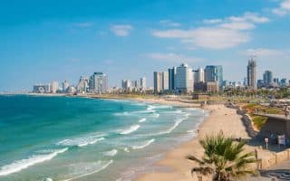
Israel's second largest city is a lively, multicultural dynamo. The signature running in Tel Aviv is the promenade along the Mediterranean. Nice runs along the Yarkon River, some cool neighborhoods, Boulevard Rothschild, and Herzliya.
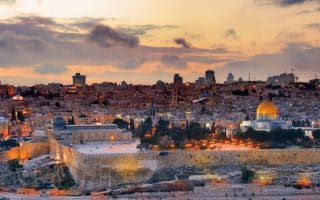
The best places to run in Jerusalem include our 'runseeing' tour, the Promenade (Tayelet), rail trail (Rekevet), The Forest, Sacher Park, and the Ben Shemen Forest. We don't recommend running in the Old City.
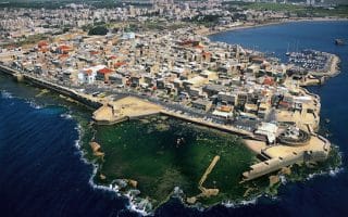
This northern Israel port city with its hilly setting overlooking the Mediterranean has some gorgeous running. Highlights are the seaside path, the Bahá'í Gardens area, the famed 1,000 Steps, Mt. Carmel National Park, and Ein Hashofet Forest.
Nice waterfront running paths in these northern Israel spots near the Lebanon border. From Nahariya, the path goes for 3 km south to Shavei Zion. From Acre, the path goes for 3 km north. Also, do a quick jaunt around the Acre Old City!
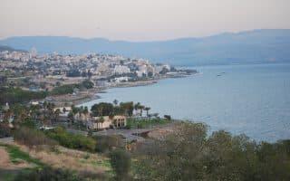
Some good running around the Sea of Galilee. A 'runseeing' tour of Tiberias Old City, including the Yigal Alon Promenade, a few km of nice running along the Jordan River, and a good section of the Israel National Trail above the sea.
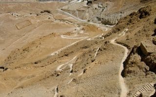
Run from the lowest place on earth! Masada's snake path which climbs 2 km and 400 meter elevation gain to the summit and wonderfully preserved Roman fortress with great views. Nearby Ein Gedi is a trail running treat.
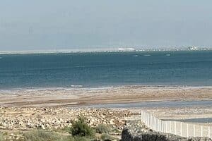
Run at the lowest point on earth! Just south of Masada, a pedestrian/cycle path runs for 9 km along the Dead Sea between Ein Bobek and Neve Zohar. Great views of the water and surrounding mountains. Get a post-run treatment at the famed Zohar Hot Springs!
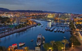
Southern Israeli port and resort town on the Red Sea near Jordan, popular with visitors. Our 6.4 km route features the beach promenade and marina, mostly off-road. Timna Park, 20 km north, has spectacular desert trail running.
Share your feedback on this route and see that of other Great Runs users. Click on the image icon to upload a photo. And please let us know if there are notes or changes we should incorporate!


Review or Comment on This Route/Share a Photo!
Share your feedback on this route and see that of other Great Runs users. Click on the image icon to upload a photo. And please let us know if there are notes or changes we should incorporate!