Although some of the best running in Jasper is on the tremendous network of trails, there are a few good options for those who want to hit the pavement. A couple of good roads for running are in or near town, while others require a bit of a drive to get there. This road biking map has excellent information about the area’s roads (shoulder, traffic count, etc.). Top recommendations for roads or gentle paths for running:
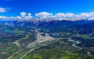
Town of Jasper. See our separate post for the best road, path, and trail running in/near town. Town Map.
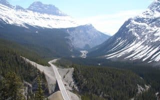
Icefields Parkway. Considered among the most scenic drives in the world, AB-93 stretches for 233 km south to Lake Louise. See this separate guide to the best sections for running.
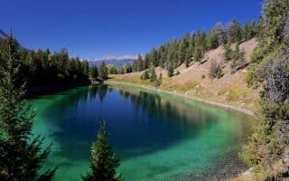
Pyramid Lake. The 14 km ride from Jasper to Pyramid Lake is popular with cyclists, but for running, the best bet is the 3-4 km section along the lake itself, including a fun jaunt out to Pyramid Island. It’s a 6-7 km run, with two modest hills. 6.3 km out and back, 71m gain. MAP Option: there’s a trail above the road that is more wooded but not too difficult.
Campgrounds Loop and Jasper SkyTram Road. For a quiet road run, one can several km around the Whistlers and Waipiti Campgrounds. It’s always fun to see the variety of camping get-ups. Trail If you want a steady climb, take the road next to the campground off AB-93 that leads to the Jasper SkyTram. It’s a steady, 250m (880 feet) climb over 3.3 km (6.6 out and back).
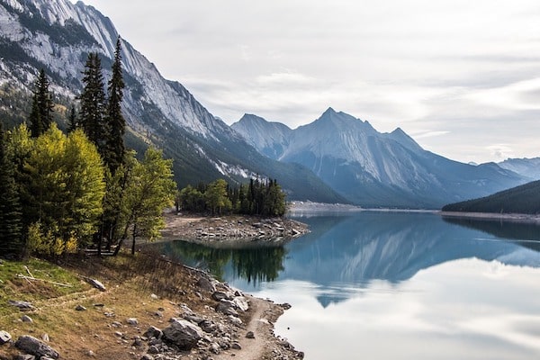
Medicine Lake. The relatively quiet Maligne Lake Rd. heads for 50+ km from Jasper to Maligne Lake. The most scenic section is the 6.5 km along Medicine Lake (25 km east of Jasper), which has lovely lake & mountain views on rolling hill terrain. MAP If you continue for another 20 km to Maligne Lake, the road ends but there’s a nice 4 km flat, semi-paved path, split along each side of the lake.
Snaring Rd. This quiet road off the Yellowhead Highway (AB-16) 12 km north of Jasper is good for running. Paved for about 5 km up to the Snaring River crossing, then it beomes more rugged and remote.
Although some of the best running in Jasper is on the tremendous network of trails, there are a few good options for those who want to hit the pavement. A couple of good roads for running are in or near town, while others require a bit of a drive to get there. This road biking map has excellent information about the area’s roads (shoulder, traffic count, etc.). Top recommendations for roads or gentle paths for running:
Town of Jasper. See our separate post for the best road, path, and trail running in/near town. Town Map.
Icefields Parkway. Considered among the most scenic drives in the world, AB-93 stretches for 233 km south to Lake Louise. See this separate guide to the best sections for running.
Pyramid Lake. The 14 km ride from Jasper to Pyramid Lake is popular with cyclists, but for running, the best bet is the 3-4 km section along the lake itself, including a fun jaunt out to Pyramid Island. It’s a 6-7 km run, with two modest hills. 6.3 km out and back, 71m gain. MAP Option: there’s a trail above the road that is more wooded but not too difficult.
Campgrounds Loop and Jasper SkyTram Road. For a quiet road run, one can several km around the Whistlers and Waipiti Campgrounds. It’s always fun to see the variety of camping get-ups. Trail If you want a steady climb, take the road next to the campground off AB-93 that leads to the Jasper SkyTram. It’s a steady, 250m (880 feet) climb over 3.3 km (6.6 out and back).
Medicine Lake. The relatively quiet Maligne Lake Rd. heads for 50+ km from Jasper to Maligne Lake. The most scenic section is the 6.5 km along Medicine Lake (25 km east of Jasper), which has lovely lake & mountain views on rolling hill terrain. MAP If you continue for another 20 km to Maligne Lake, the road ends but there’s a nice 4 km flat, semi-paved path, split along each side of the lake.
Snaring Rd. This quiet road off the Yellowhead Highway (AB-16) 12 km north of Jasper is good for running. Paved for about 5 km up to the Snaring River crossing, then it beomes more rugged and remote.
Review or Comment on This Route/Share a Photo!
Share your feedback on this route and see that of other Great Runs users. Click on the image icon to upload a photo. And please let us know if there are notes or changes we should incorporate!