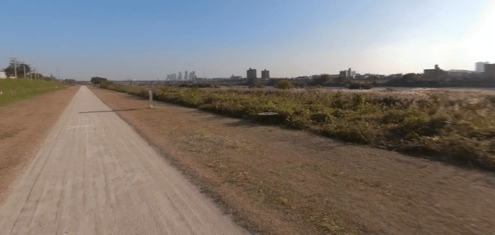
The Tama River trail is one of the best ways to go on a long, uninterrupted run in Kawasaki. The Tama River divides the border between Kawasaki and Tokyo. There are trails that run for 40+ km from the Fussa station line in the north, all the way to the sea. From Tamagawa Futako Bridge Park headed toward the sea, it’s a nearly uninterrupted green space forming a linear park. A couple of good options:
10k loop. In the Kawasaki area, a good 10k+ loop is between the Numabe and Futakotamagawa stations, using paths on both banksof the river. The paths in this area are mainly dirt, and the landscape is fairly open, rather than wooded, with several parks. There are occasional water views, but the river is quite narrow. Add on with some nice trails in Tamagawa Futako Bridge Park. There’s a running track in the area of the Todoroki Athletics Stadium, on the south bank just across the Maruko Bridge.
South to the Sea. From the Numabe station, there are nice paths along the left bank of the river that run for 11 km toward Tokyo Bay. The route passes through several parks and green spaces.

Review or Comment on This Route/Share a Photo!
Share your feedback on this route and see that of other Great Runs users. Click on the image icon to upload a photo. And please let us know if there are notes or changes we should incorporate!