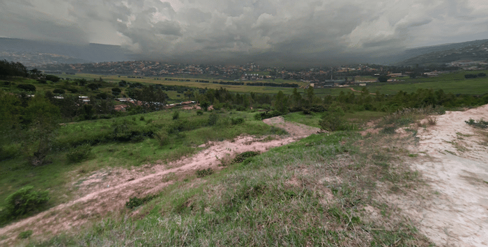
We’ve mapped a few of routes in Kagugu, a somewhat upscale area in the northeast part of Kigali, favored by expats and the location of numerous international schools. These routes feature some nice open countryside terrain through villages and fields, and aren’t too hilly.
Route 1: 12.6 km. Start near the golf course at the intersection of KG 9 & KG 12, starting with a 70m climb. It’s a straight shot north on KG 14 for 2 km to the Kagugu Primary School. Continue onto KG 24, which travels for 6 km, passing the Mount Hermon place of worship, looping around and heading back south. At the 8 km mark, the road turns into the KG 438, returning to the Primary School. Use KG 375 St. for the final 3 km.
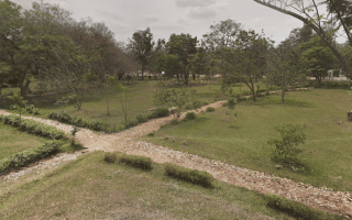
- Add-On/Variation: Golf Course 5k: Do a loop that skirts the east side of the golf course. There are good sidewalks along the road and it’s pleasant for running. Use KG 13 Ave./KG 535 St. south, then loop back north on KG 592, returning to KG 13.
Route 2. 7.4 km. This shorter route is more in the eastern part of the area. Start on KG 14 near the Narine Medical Center. Use KG 399/419, connecting to KG 452 St,. at the 2 km mark. Head east for 1.5 km, LEFT on KG 387 to the Kagugu Primary School, then LEFT on KG 438 for 1.5 km. At the 5k mark, LEFT on KG 759, then return to the start on KG 766.
We’ve mapped a few of routes in Kagugu, a somewhat upscale area in the northeast part of Kigali, favored by expats and the location of numerous international schools. These routes feature some nice open countryside terrain through villages and fields, and aren’t too hilly.
Route 1: 12.6 km. Start near the golf course at the intersection of KG 9 & KG 12, starting with a 70m climb. It’s a straight shot north on KG 14 for 2 km to the Kagugu Primary School. Continue onto KG 24, which travels for 6 km, passing the Mount Hermon place of worship, looping around and heading back south. At the 8 km mark, the road turns into the KG 438, returning to the Primary School. Use KG 375 St. for the final 3 km.
- Add-On/Variation: Golf Course 5k: Do a loop that skirts the east side of the golf course. There are good sidewalks along the road and it’s pleasant for running. Use KG 13 Ave./KG 535 St. south, then loop back north on KG 592, returning to KG 13.
Route 2. 7.4 km. This shorter route is more in the eastern part of the area. Start on KG 14 near the Narine Medical Center. Use KG 399/419, connecting to KG 452 St,. at the 2 km mark. Head east for 1.5 km, LEFT on KG 387 to the Kagugu Primary School, then LEFT on KG 438 for 1.5 km. At the 5k mark, LEFT on KG 759, then return to the start on KG 766.

Review or Comment on This Route/Share a Photo!
Share your feedback on this route and see that of other Great Runs users. Click on the image icon to upload a photo. And please let us know if there are notes or changes we should incorporate!