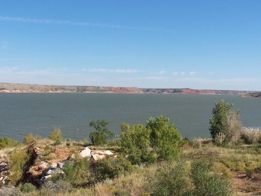
Lake Meredith National Recreation Area is a cliff-lined lake area, known for its spectacular scenery and popular for boating, fishing, and hiking. Part of the National Park system, Lake Meredith is located 70 miles north of Amarillo and is must see if in the area. There are many miles of hiking trails that are also terrific for trail running. Many of the trails here are more rugged and challenging than the Palo Duro Canyon, the area’s other main attraction. The hiking/running trails are also in distinct areas. Most recommended for running are:
Flickr: Sarowen
Turkey Creek Trail. Probably the best bet for running. Located near the Park HQ and Visitor Center. Overall, it’s 16.5 miles of rolling hills, lake views, and deep canyons — but the first 6 miles along the shoreline of Lake Meredith to South Turkey Creek is a good run.
Mullinaw Trails. At the southern end of the park. Overall there are 4.3 miles of trails, but the 2.25-mile orange spur along the banks of the Canadian river is the main part of the trail and good for running.
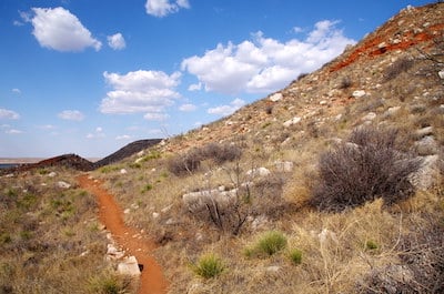
Harbor Trail. Challenging, and only for experienced trail runners. The most spectacular trail at Lake Meredith, covers from Harbor Bay to Meredith Way, including 2 loops. The terrain consists of a variety of gently rolling hills, steep slopes with steps, and switchback, through canyons and mesas.
NOTE: Most trails are exposed and it can be brutally hot in summer. Use caution and plan accordingly.
Lake Meredith National Recreation Area is a cliff-lined lake area, known for its spectacular scenery and popular for boating, fishing, and hiking. Part of the National Park system, Lake Meredith is located 70 miles north of Amarillo and is must see if in the area. There are many miles of hiking trails that are also terrific for trail running. Many of the trails here are more rugged and challenging than the Palo Duro Canyon, the area’s other main attraction. The hiking/running trails are also in distinct areas. Most recommended for running are:
Flickr: Sarowen
Turkey Creek Trail. Probably the best bet for running. Located near the Park HQ and Visitor Center. Overall, it’s 16.5 miles of rolling hills, lake views, and deep canyons — but the first 6 miles along the shoreline of Lake Meredith to South Turkey Creek is a good run.
Mullinaw Trails. At the southern end of the park. Overall there are 4.3 miles of trails, but the 2.25-mile orange spur along the banks of the Canadian river is the main part of the trail and good for running.
Harbor Trail. Challenging, and only for experienced trail runners. The most spectacular trail at Lake Meredith, covers from Harbor Bay to Meredith Way, including 2 loops. The terrain consists of a variety of gently rolling hills, steep slopes with steps, and switchback, through canyons and mesas.
NOTE: Most trails are exposed and it can be brutally hot in summer. Use caution and plan accordingly.
Scroll Down For Route Maps
Essentials
See trail map and descriptions
Depends on trail chosen. Ranges from flat to steep
Depends on trail chosen.
Located 70 miles north of Amarillo. Park HQ/Visitor Center is a good anchor point
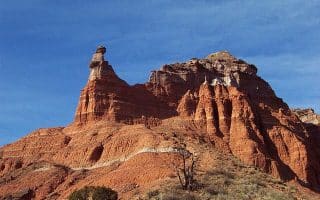
The second largest canyon in the USA is Amarillo's primary attraction. It's also heaven for running: several trails, with something for every level of difficulty. The Lighthouse Trail is the iconic route. Try to do it near sunrise or sunset to capture the rock colors!
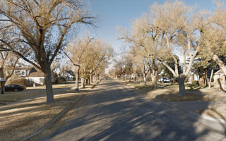
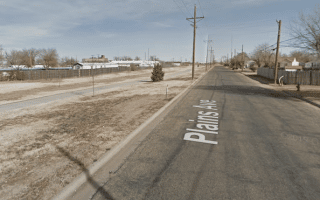
The best spot for a run in downtown Amarillo is to enjoy some of the attractive residential streets between Taylor and the I-40 that recall the city's economic heyday. The highlight is S Polk St., which features attractive, historic buildings and homes.
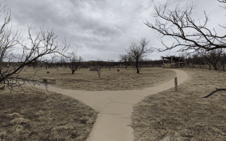
One of our favorite places for running in Amarillo. Located 8 miles west of downtown, the Nature Center features 6 miles of easy-to-moderate trails for running, showcasing the area's native grasslands. Add on with the Old Soncy multi-use path.
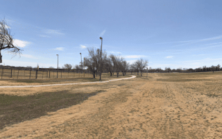
John Stiff Memorial Park is the largest park in Amarillo for running. There are 4-5 miles of paths, including an 0.8 mile loop around McDonald Lake. For a longer run, connect to The Greenways park & neighborhood.
Share your feedback on this route and see that of other Great Runs users. Click on the image icon to upload a photo. And please let us know if there are notes or changes we should incorporate!
Subscribe
0 Comments
Oldest
Newest
Inline Feedbacks
View all comments
Essentials
See trail map and descriptions
Depends on trail chosen. Ranges from flat to steep
Depends on trail chosen.
Located 70 miles north of Amarillo. Park HQ/Visitor Center is a good anchor point

Review or Comment on This Route/Share a Photo!
Share your feedback on this route and see that of other Great Runs users. Click on the image icon to upload a photo. And please let us know if there are notes or changes we should incorporate!