Features:
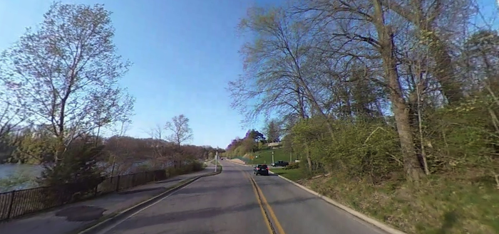
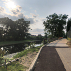
This is a pleasant run on the south side of the Grand River, showcasing Frances Park and the lovely homes along the riverside Moores River Dr. We’ve mapped a 5.2 mile out & back route, but this can be combined with the Lansing River Trail at Moores Park.
The western edge of this route is at the intersection of Moores River Dr. & W Mt. Hope Dr. Run east along Moores River Dr. for 0.6 km. At Frances Park, enjoy a lop around the park’s paths, fields, and rose garden. Then, continue east along Moores River Dr. for another 1.5 miles. This is a scenic road, with gracious older homes and glimpses of the Grand River. The turnaround point is at Moores Park.
Add-Ons: At Moores Park, can continue east on the Lansing River Trail for up to 5 miles to the SMU campus, with northern & southern spur options shown in our other Lansing routes.
- 5.2 miles (8.4 km) out & back
- 111 feet (34m)
- Moores River Dr. & W Mt. Hope Dr.
- Frances Park has parking

Comment on this Route/Share a Photo!
Share your feedback on this route and see that of other Great Runs users. Click on the image icon to upload a photo. And please let us know if there are notes or changes we should incorporate!