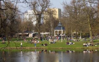
Leipzig lies at the confluence of the narrow rivers White Elster, Pleiße and Parthe. There’s a good network of waterside multi-use paths, with numerous adjacent parks and riparian forest preserves containing additional trails. We’ve mapped a northern and southern river route, starting from just west of the center in Clara-Zetkin-Park.
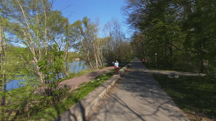
Northern Route: Pleasant running along the Elsterbecken and Neue Luppe rivers for up to 9 km one-way. The path, some paved but mainly gravel, is on the eastern side of the river, with water views along a good section although blocked by trees in some areas. Points along the way include Red Bull Arena at 2 km (running track, and Auwald forest across the way), Auensee Lake (5 km), and the pretty Schloßpark Lützschena at 8 km.
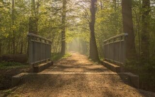
Southern Route: This is the shorter route, headed south for 3.5 km from Clara-Zetkin-Park along the Elsterflutbett and Pleiße rivers. The gravel path is on the eastern side of the water, except for a brief section on the western side. At the southern end of the path, the Elster-Pleiße-Auwald (riparian forest) has an attractive wooded path for running on the western side of the river.
Leipzig lies at the confluence of the narrow rivers White Elster, Pleiße and Parthe. There’s a good network of waterside multi-use paths, with numerous adjacent parks and riparian forest preserves containing additional trails. We’ve mapped a northern and southern river route, starting from just west of the center in Clara-Zetkin-Park.
Northern Route: Pleasant running along the Elsterbecken and Neue Luppe rivers for up to 9 km one-way. The path, some paved but mainly gravel, is on the eastern side of the river, with water views along a good section although blocked by trees in some areas. Points along the way include Red Bull Arena at 2 km (running track, and Auwald forest across the way), Auensee Lake (5 km), and the pretty Schloßpark Lützschena at 8 km.
Southern Route: This is the shorter route, headed south for 3.5 km from Clara-Zetkin-Park along the Elsterflutbett and Pleiße rivers. The gravel path is on the eastern side of the water, except for a brief section on the western side. At the southern end of the path, the Elster-Pleiße-Auwald (riparian forest) has an attractive wooded path for running on the western side of the river.

Review or Comment on This Route/Share a Photo!
Share your feedback on this route and see that of other Great Runs users. Click on the image icon to upload a photo. And please let us know if there are notes or changes we should incorporate!