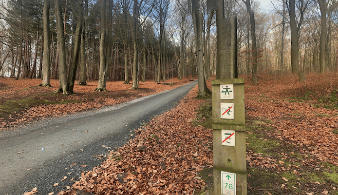
In southern Leuven in the area just south of the E40 Highway, there’s some nice running in two adjacent areas: Heverleebos is the National Woods, with several miles of trails, while just west of there is the Vijvers van Oud-Heverlee Nature Preserve, which has dirt/grass paths.
Heverleebos. Several miles of mainly wooded paths. A nice route is from the Arboretum west, and then south to the Kasteel harcourt (3 km), and then another 1.5 km on paths along Zoet Water (lake).
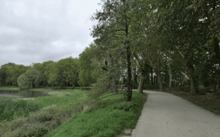
Oud-Heverlee. Google Street View
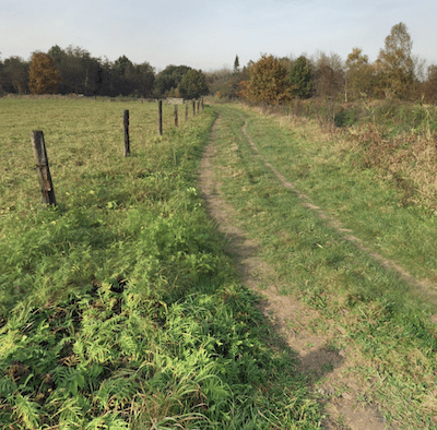
Vijvers van Oud-Heverlee Nature Preserve. This preserve, just south of the E40/A3, has dirt/grass path alongside the River Dyle and a lake. A nice option is a route of up to 5.4 km one-way along the river to the Kasteel Van Neerijse (castle), or even longer continuing south to Huldenberg. Can also connect to Heverleebos using our mapped route.
Grand Loop. We’ve mapped a 12 km loop oute combining the two areas. Use it as a guideline for running your desired length and connecting the two.
In southern Leuven in the area just south of the E40 Highway, there’s some nice running in two adjacent areas: Heverleebos is the National Woods, with several miles of trails, while just west of there is the Vijvers van Oud-Heverlee Nature Preserve, which has dirt/grass paths.
Heverleebos. Several miles of mainly wooded paths. A nice route is from the Arboretum west, and then south to the Kasteel harcourt (3 km), and then another 1.5 km on paths along Zoet Water (lake).
Oud-Heverlee. Google Street View
Vijvers van Oud-Heverlee Nature Preserve. This preserve, just south of the E40/A3, has dirt/grass path alongside the River Dyle and a lake. A nice option is a route of up to 5.4 km one-way along the river to the Kasteel Van Neerijse (castle), or even longer continuing south to Huldenberg. Can also connect to Heverleebos using our mapped route.
Grand Loop. We’ve mapped a 12 km loop oute combining the two areas. Use it as a guideline for running your desired length and connecting the two.
Scroll Down For Route Maps
Essentials
Grand Loop: 12.3 km (7.7 miles). Other distance options
111m (367 feet)
Heverleebos: the Arboretum at the east end is a good starting point
Oud Heverlee: Access off the N253Parking areas. Train: Oud-Heverlee
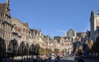
An enjoyable 'runseeing' tour of Old Town, hitting all the highlights of the beautifully preserved historic center inside of the R23 ring road. Can follow our route or create your own using our outline.
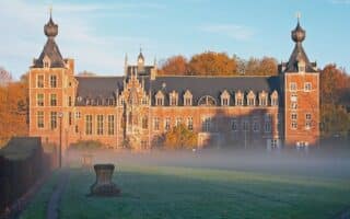
Scenic university campus, trails along a river with woods, farmland, a castle, and a running track. All in one 7 km out and back run. Can also access from the historic center and extend into the Vijvers van Oud-Heverlee nature preserve.
There are 4-5 km of paths around fields and lakes in Provinciedomein Kessel-Lo, Leuven's largest park. For a long run, combine with canal paths extending north for several km.
Share your feedback on this route and see that of other Great Runs users. Click on the image icon to upload a photo. And please let us know if there are notes or changes we should incorporate!
Subscribe
0 Comments
Oldest
Newest
Inline Feedbacks
View all comments
Essentials
Grand Loop: 12.3 km (7.7 miles). Other distance options
111m (367 feet)
Heverleebos: the Arboretum at the east end is a good starting point
Oud Heverlee: Access off the N253Parking areas. Train: Oud-Heverlee

Review or Comment on This Route/Share a Photo!
Share your feedback on this route and see that of other Great Runs users. Click on the image icon to upload a photo. And please let us know if there are notes or changes we should incorporate!