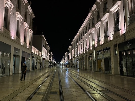
One of our favorite things about Tours is its several long, wide streets, allowing for a nice exploration of the city and its major sites without a lot of turns. Use the Place Jean Jaurès, with the spectacular Hôtel de Ville de Tours (City Hall) as an anchor point. From there, Bd. Béranger is a wide street with a tree-lined median that runs east-west, while Rue Nationale is a wide pedestrian street that runs south toward the river (and beautifully lit at night!).
Mark Lowenstein
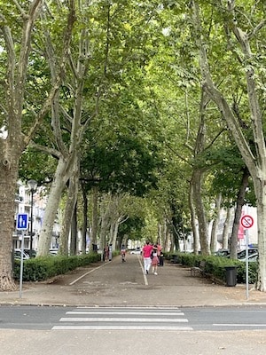
Starting at Place Jean Jaurès, head east briefly on Bd. Béranger, then toward the river on R Jules Simon, passing the Cathédrale Saint-Gatien and the Château de Tours. Use the pedestrian bridge to cross over the Loire River, then head west on the river path to Pont Wilson (or Pont Napoleon for a slightly longer run). Cross back over, using Rue des Tanneurs as the anchor point for your own exploration of Vieux Tours, the historic old town.
Add-Ons: Use our mapped route to create your own additional exploration of the river paths, paths around l’île Simon, bridges, and streets of Vieux Tours.
One of our favorite things about Tours is its several long, wide streets, allowing for a nice exploration of the city and its major sites without a lot of turns. Use the Place Jean Jaurès, with the spectacular Hôtel de Ville de Tours (City Hall) as an anchor point. From there, Bd. Béranger is a wide street with a tree-lined median that runs east-west, while Rue Nationale is a wide pedestrian street that runs south toward the river (and beautifully lit at night!).
Mark Lowenstein
Starting at Place Jean Jaurès, head east briefly on Bd. Béranger, then toward the river on R Jules Simon, passing the Cathédrale Saint-Gatien and the Château de Tours. Use the pedestrian bridge to cross over the Loire River, then head west on the river path to Pont Wilson (or Pont Napoleon for a slightly longer run). Cross back over, using Rue des Tanneurs as the anchor point for your own exploration of Vieux Tours, the historic old town.
Add-Ons: Use our mapped route to create your own additional exploration of the river paths, paths around l’île Simon, bridges, and streets of Vieux Tours.
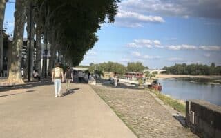
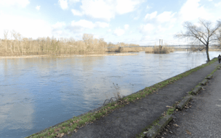
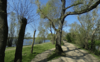
Paths along the Loire River extend in both directions from the city's historic center, featuring wonderful water views. Within a few km, the scene becomes increasingly pastoral. The lake loop on Île Charlemagne is also lovely.
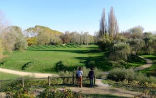
A popular landscaped park 8 km south of Orleans. Create your own route combining the park paths, adjacent University of Orléans campus, and running track.
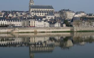
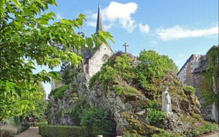
Nice running options in this picturesque hillside town. Our 'runseeing' tour features the Château Royal de Blois, famous Escalier Dens-Papin, & levée paths out to the Parc des Mées. Good options for a longer run on levée paths on both sides of the Loire River.
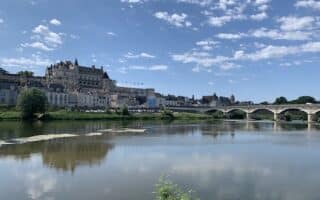
A run that has it all: paths along the Loire River, the grounds of three castles, historic churches, and great views. Ambroise is a Loire Valley town located 22 km east of Tours.
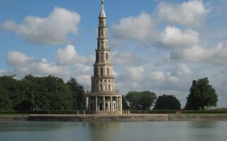
A good off-road running option just south of Ambroise. Enjoy the Loire Valley views at Chanteloup Pagoda, then run for 3+ km along a wooded path, with an option to continue on pretty vineyard roads to the Domaine des Malidores winery. Flat!
For a pastoral run in Tours with lots of variety, head just south of the city to combine paths along the Cher River, the Parc Honoré de Balzac island park, Parc du Lac, and the fields of Parc de la Gloriette. Water views, park paths, and fun bridges.
Chinon is another popular stop on a Loire Valley tour, known for its Forteresse Royale de Chinon. Our route incorporates a loop on quiet roads past fields & farms on the south side of the river, and then an inspiring approach to the hilltop castle.
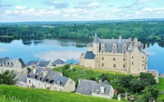
River paths, castles, and hillside vineyard roads make for scenic running in these beautiful adjacent villages. We've put together some routes that can be run standalone or combined, including to the confluence of the Loire & Vienne Rivers.
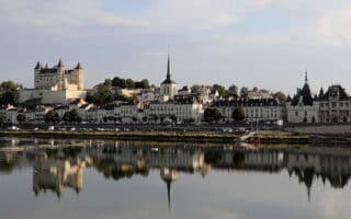
A classic Loire Valley run, with paths along the Loire & Thouet Rivers, and a loop around the hilltop Château de Saumur. Overall it's 13 km, with options for different distances.
Up to 11 km of scenic paths along the Maine River from central Angers, with great water views and a pastoral scene. Additional paths on the Mayenne and Sarthe tributaries.
A scenic run combining the pleasantly landscaped paths of Parc Balsac with a 5 km loop on scenic paths around Lac de Maine. Nice green spaces & water views. Can add with Maine River paths, & paths through the wooded Parc Saint Nicolas.
Run a loop around the only village to lie on an island in the Loire Valley! Scenic paved walking paths ring the low-trafficked island, forming a flat 9 km loop. The terrain is pastoral, with open fields, farms, and river views. 15 km south of Angers.
A great opportunity to experience some scenic running in hillside vineyards. Savennières is a village just north of Ile Béhuard, 15 km south of Angers. Create your own route on hillside roads, or combine with the Chemin des Perrières pedestrian path.
The Loire à Vélo Cycle Path is a beautiful long-distance cycle route in France, stretching 900 km. Much of it follows the Loire River towns covered in our Loire Valley guide. Use it as a resource to find a run or extend one of our routes. Great website, interactive map.
Share your feedback on this route and see that of other Great Runs users. Click on the image icon to upload a photo. And please let us know if there are notes or changes we should incorporate!


Review or Comment on This Route/Share a Photo!
Share your feedback on this route and see that of other Great Runs users. Click on the image icon to upload a photo. And please let us know if there are notes or changes we should incorporate!